In continuation of Part-1 : Kathmandu-Jiri-Namche Bazar
April 26th : In Namche Bazar (Acclimatisation)


April 26th : In Namche Bazar (Acclimatisation)
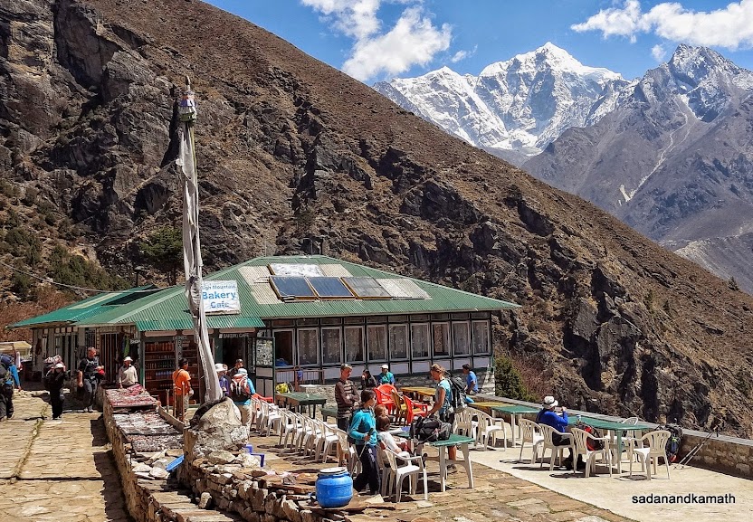
Generally, on acclimatisation day at a higher altitude, instead of taking a full day rest, it is advisable to attempt at least half a day trek to a higher altitude than the sleeping altitude which is supposed to help acclimatisation. We were to visit Everest View Point today which was about 3.5 kms of a steep climb from Namche Bazar involving an altitude gain of about 400m. Since early morning, the weather had turned cloudy with little chance of viewing the Mt. Everest and other peaks from Everest View Point. So we postponed the trek to afternoon. At 3000m+ altitude, the weather generally turns cloudy in the afternoon. So I was not very hopeful that we would be able to undertake the trek in the afternoon.
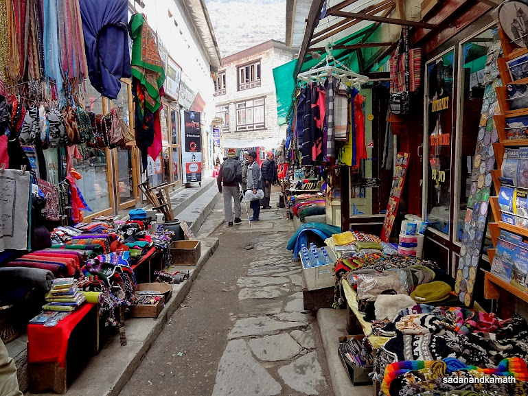
After breakfast at around 8.00 a.m., myself and PKD decided to visit the market area of Namche Bazar as KS opted to take rest in his room. PKD wanted to buy a small torch, a thermal inner wear, socks and some medicine. I also wanted to buy two pairs of thick socks to withstand the cold at higher altitudes. Being Saturday, it was a day of weekly market, called Saturday Market where people from surrounding villages bring rice, millet, other grocery items, eggs, vegetables, meats, corns, cheese and some locally made mementos for selling. The market was crowded and almost all the designated open spaces were fully occupied by the sellers. Surprisingly, as PKD pointed out, the market was not noisy. Neither sellers were soliciting business nor were murmurs of bargaining from the buyers. Everything was going on smoothly. The Saturday Market is supposed to be a full day affair but I found that almost half of the sellers had already left by afternoon.
After strolling in the market for some time and buying things required by us, we returned to our lodge. PKD and myself had lunch of boiled rice and chicken curry. Namche Bazar was the last place for getting chicken dishes. From here onward, one would get only pre-cooked chicken items for chicken soup and chicken momos as told to us later by some guides on the trek.
In the afternoon, myself and KS had LPG heated hot shower bath (NRs.200/-). PKD had his usual 'customised sponge' bath. While taking bath, KS got a mild pain in the lower back. The pain persisted during the rest of the day. He felt that whether pain would subside or remain would be known only tomorrow morning. So he had his finger crossed for his fitness for the next day's scheduled trek to Phortse Thanga on our way to Gokyo.
Myself and PKD repeated the lunch menu for our dinner while KS had vegetable-cheese pizza. By 8.30 p.m., we all retired to the beds hoping that KS would give us the positive news about his back ache the next morning.
A few pictures taken during the day below:
 |
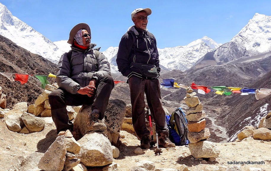
PKD outside Everest Hotel, Namche Bazar where we stayed for 3 nights.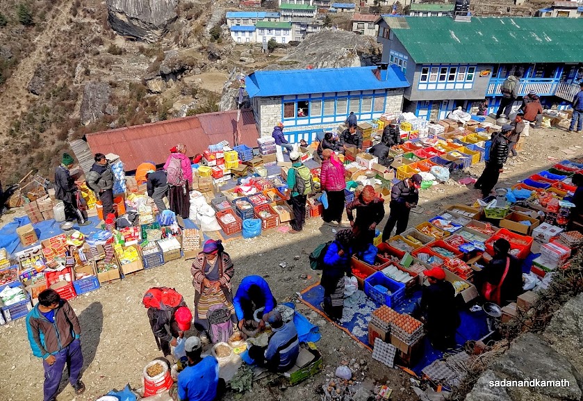 |
Sellers at one part of the Saturday Market in Namche Bazar
One of the shopping alleys in Namche Bazar.
April 27th : Acclimatisation Trek around Namche Bazar (7 kms), 5 hours.
Namche Bazar (3420m)-Everest View Point (3880m)-Khumjung (3790m)-Syangboche (3740)-Namche Bazar (3420m)
KS got up around 5.00 a.m. so did myself, eager to get the news about his back ache. The sky was clear and we could see some snow clad peaks from our room windows. Now only thing remained to add to this positive note was to let KS give us the positive news that his back ache has vanished! But he gave us a 'middle of the road' news that though the pain had reduced a bit but he can still feel the pain while walking. Both myself and PKD suggested that we could extend our stay in Namche Bazar by one more day so that KS could rest to hasten the recovery of his back ache.
The additional rest day coupled with a bright sunshine prompted me and PKD to go for the acclimatisation trek after the breakfast today. So, we had an early breakfast of bread toast, omellete and fried potatoes. During the breakfast, I told KS that I expect to get some positive news about his back ache once we return from acclimatisation trek in the afternoon. My optimism was based on his morning remarks that the pain had reduced to some extent.
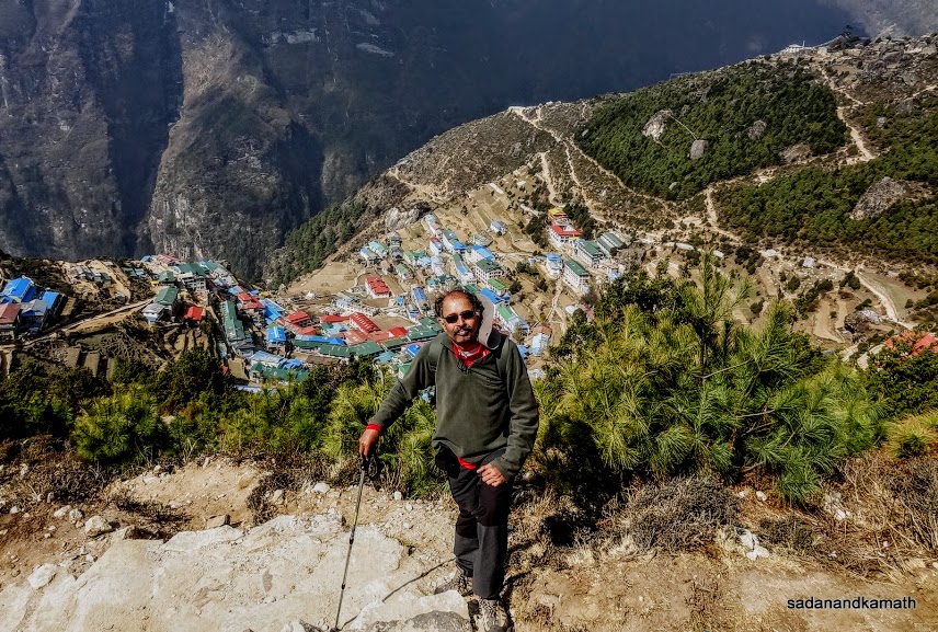
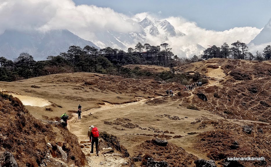
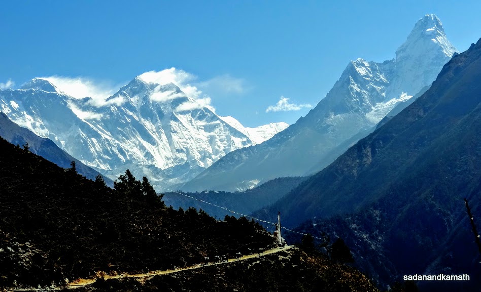
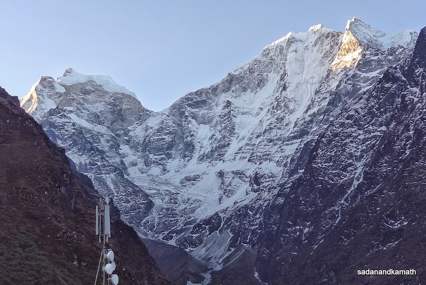
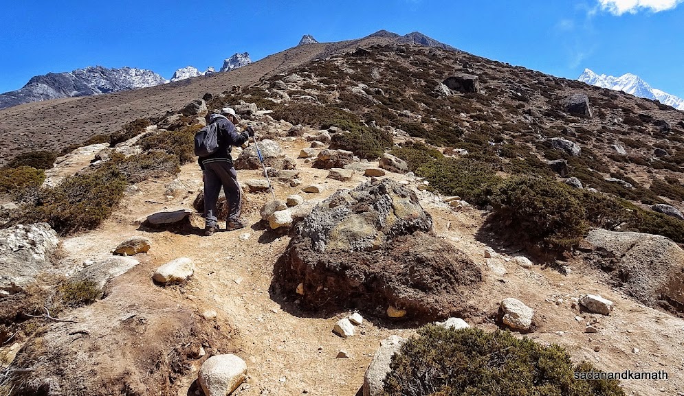
We commenced our acclimatisation trek at 7.45 a.m. with two of our three porters namely Shrikrishna and Rohit joining us. Ram Rai was to remain in the lodge to assist KS. We took the bazar route involving steep climbs within Namche Bazar which joined the Tengboche trail near a chorten. The climbing trail left of the chorten was for Everest View Point (3880m). Judging from the heavy sacks carried by some trekkers on this trail, I guessed that they may have taken this route via Khumjung to later join at Sanasa either for Phortse Thanga (for Gokyo) or Tengboche (for EBC).
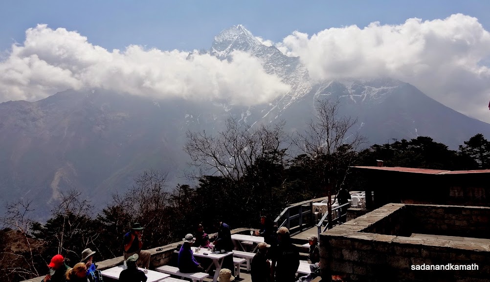
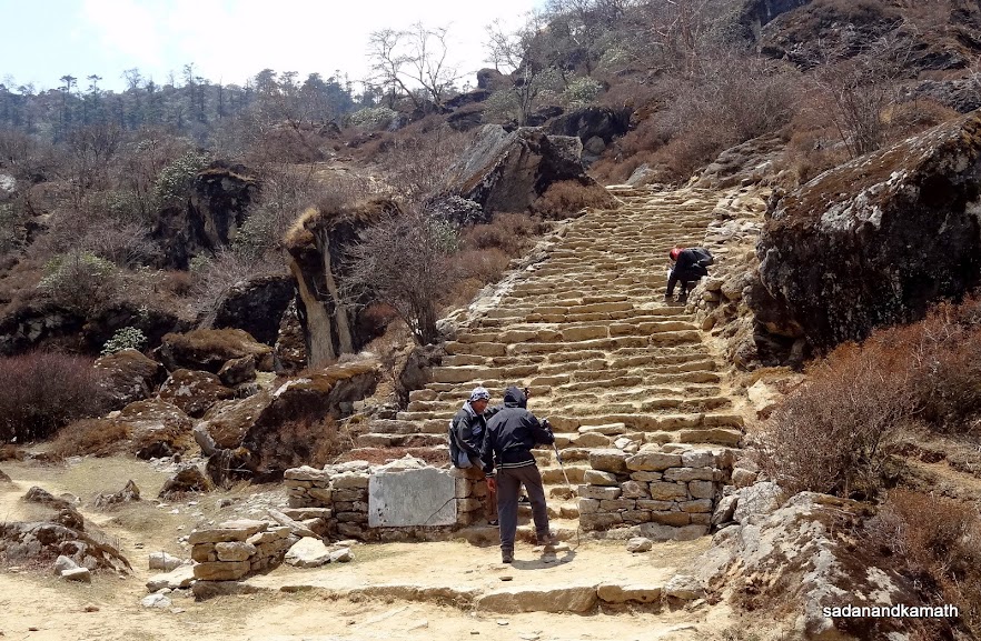
The trail to Everest View Point was a steep climb until we reached a plateau where Everest Sherpa Lodge was located. Thereafter, it was more or less a plain walk of about 2 kms skirting the Everest Sherpa Lodge. It is from this trail that one can see Mt. Everest and other peaks. Unfortunately, much of the peak view was covered with white clouds. After a short gradual climb, we reached stone stairs leading to Everest View Hotel. It was only after entering the hotel lobby, we came to know that the Everest View Point was the open restaurant of Everest View Hotel.
We could not get to see Mt. Everest and other peaks as, apart from the haze, they continued to be covered with white clouds. However, we could see somewhat hazy looking Pheriche village (EBC route) and Mong La Pass (Gokyo route) from the hotel's open restaurant.
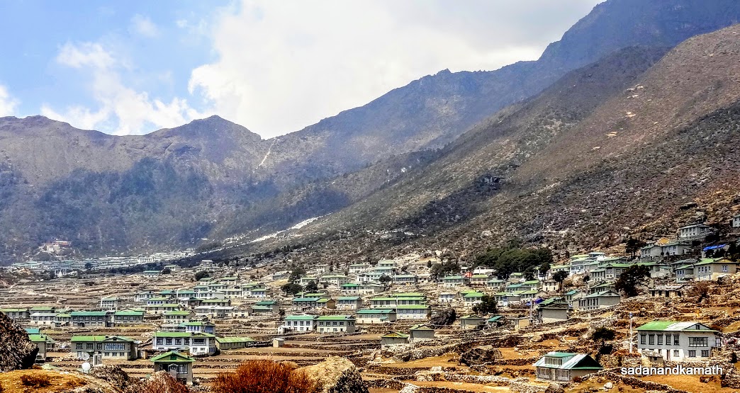
After spending about 30 minutes in the open restaurant, we came out of the hotel. Our earlier plan was to return to Namche Bazar by the same route. But as soon as we got down from Everest View Hotel, we could see Khumjung village in the valley which looked great with all houses having green roofs. Shrikrishna told us that we could return to Namche Bazar through Khumjung via Syangboche. The Khumjung valley was looking great. So we decided to follow the Khumjung route to Namche Bazar.
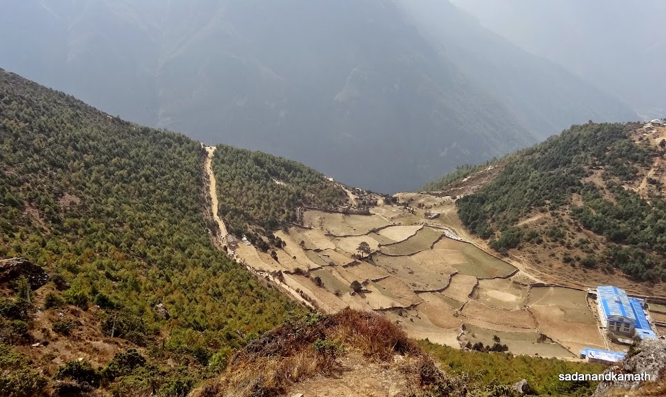
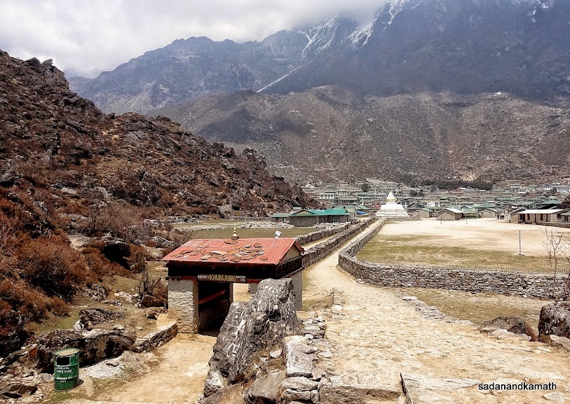
A steep descend of about one km from Everest View Hotel landed us in the middle of Khumjung village (3790m) which is also called as 'the heartland of Sherpas'. I guess this must be one of the well planned and the largest village in Khumbu region at this altitude. The village has a large ground for sports activities, secondary high school (Hillary School) and a hospital. Another feature of this village is that it has one of the longest Mani walls (nearly one km long) starting from the Namche Bazar side gate and goes to the sport ground near Hillary High School.
After the Namche side gate to Khumjung village, a gradual climb to Khumjung Pass started. As we reached near the pass, we saw a couple of villagers trying to move an angry and stubborn yak which had taken a shelter inside a natural rock cave. The two villagers were struggling for more than two hours to make the yak move from the cave but without success. It was only when our porters joined them, they could move the yak out of the cave. We were told to clear off the trail and stand on a higher place. That was a good suggestion as we saw the yak suddenly ran out of the cave very fast on the trail. We could see from the pass that in no time the yak had crossed Syangboche airstrips which is about one km further from Khumjung Pass. Luckily no one was on the trail. Now we know why yaks, though look sober, are really a dangerous animal when they are angry.
After Khumjung Pass, it was all down hills up to Syangboche airstrip. The steep descends continued after this until we reached our hotel via the Namche Monastery. KS was waiting to join us for lunch in our hotel. The news about his back ache was not encouraging. While a sort of gloom prevailed in our room with this news, the weather outside also became gloomy with overcast sky. Soon it started drizzling accompanied by thundering and lightening. The valley in front of our window was completely covered with hanging clouds.
Soon after the dinner, we had discussions about the alternate plans for the next day in case KS was not able to join us for the trek to Phortse Thanga ( on Gokyo route). KS suggested that myself and PKD should continue the trek as per schedule for the next day. He could join us after a couple of days if he felt alright. Otherwise, he would go back home once he was able to trek to Lukla. PKD suggested that in case KS was not able to join us for the trek, we should consider changing the itinerary giving first preference to EBC and then to Gokyo. This was agreed as it made sense for both of us who had not done EBC trek to achieve the milestone. We called our porters to apprised them our changed itinerary and asked them to decide as to who would stay with KS in Namche. While porters had no problem with changed itinerary, they indicated that they would decide in the next day morning as to which porter would stay with KS. Apparently, they wanted to consult Puru before deciding as to who would be staying with KS.
Some pictures taken during the day below:
 |
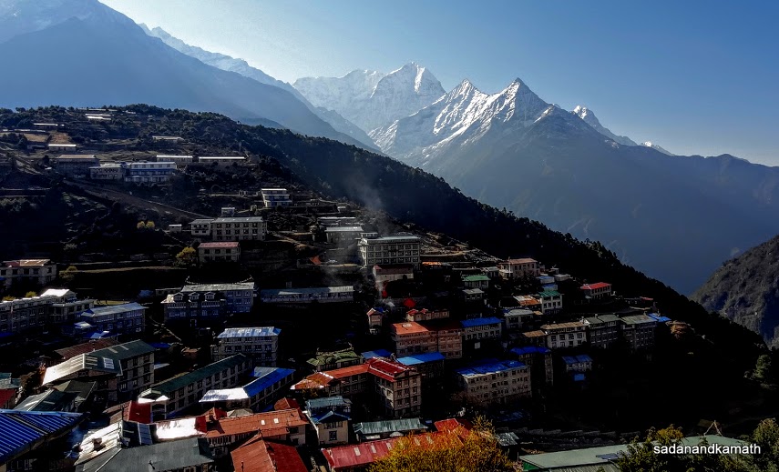
Early morning peak view from the window of our hotel room, Namche Bazar.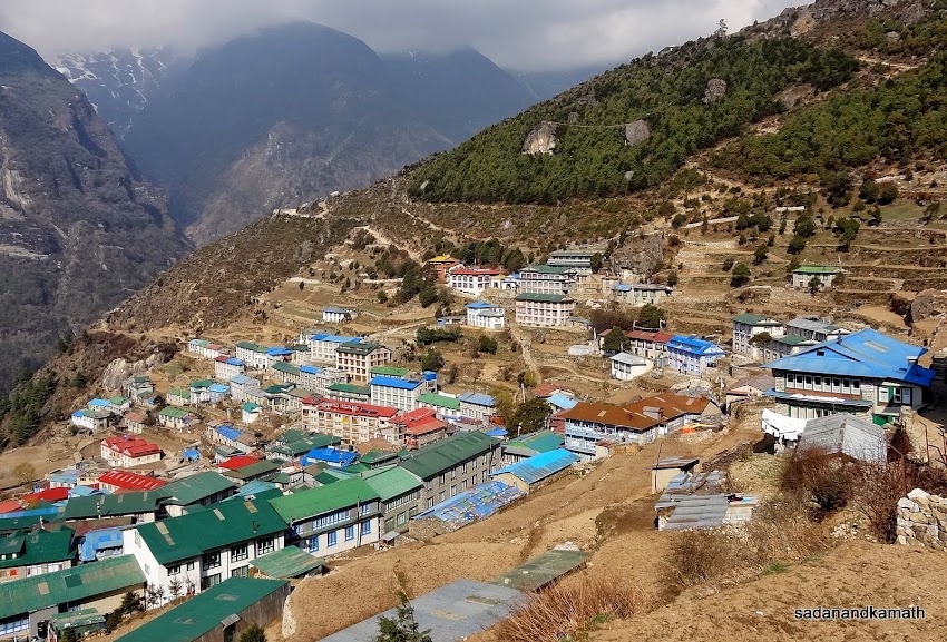 |
View of Namche Bazar from the initial climbs to Everest View Point.
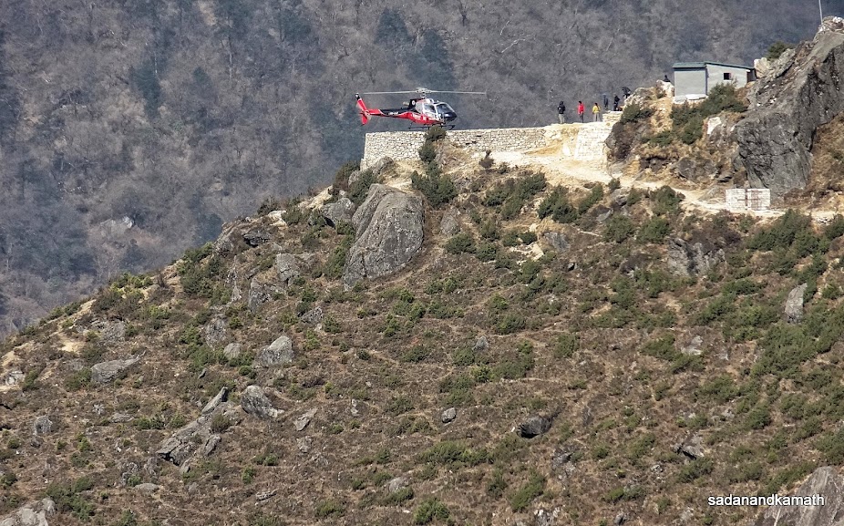 |
A rescue helicopter lands at a helipad above Namche Bazar. This helipad is also used by Everest View Hotel for bringing the guests to their hotel who can afford helicopter charges.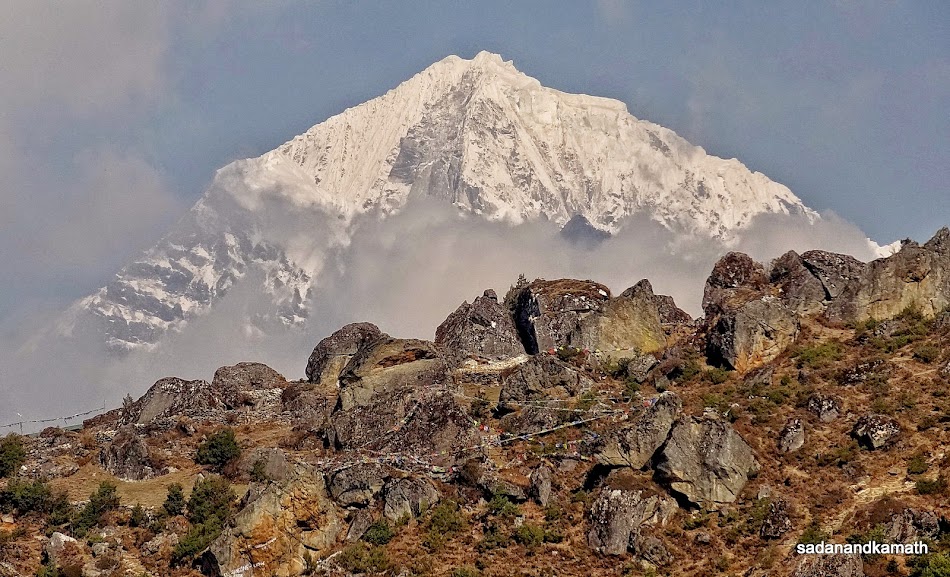 |
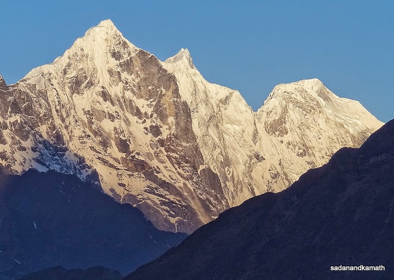
Thamsekru peak ? seen from climbs to Everest View Point.
Namche Bazar in the valley seen from the mid point to Everest View Point.
The trail to Tengboche seen from mid point to Everest View Point.
Numbur peak seen from the way to Everest View Point.
We are close to Everest View Hotel (behind pine trees). The open restaurant of the hotel is the Everest View Point.
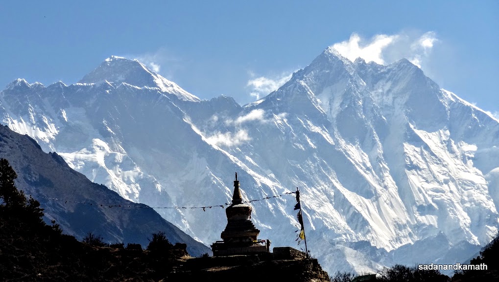
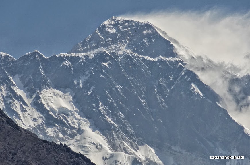
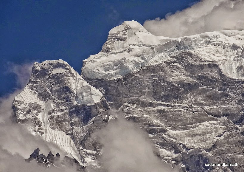
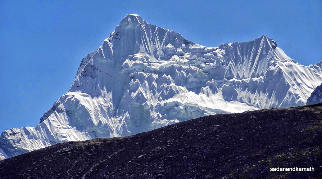
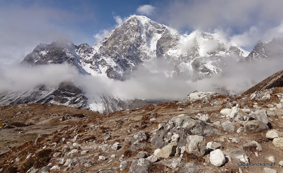
Everest View Point is actually an open restaurant of Everest View Hotel (3880m). Due to white clouds, only Kangtega peak is visible. Mt. Everest is supposed to be at the extreme left of the picture but covered by cloud.
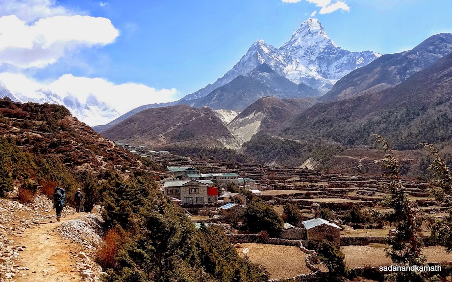
Khumjung village (3790m).
A big ground in Khumjung village. Two houses beyond chortens are lodges.
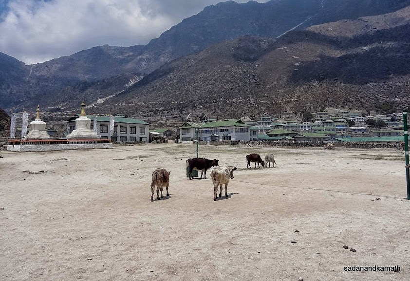
Khumjung village gate from Namche Bazar side. Beyond the gate is one of the longest Mani walls which continues to the village in the background.
The short climb to Khumjung Pass starts from here before reaching Namche Bazar.
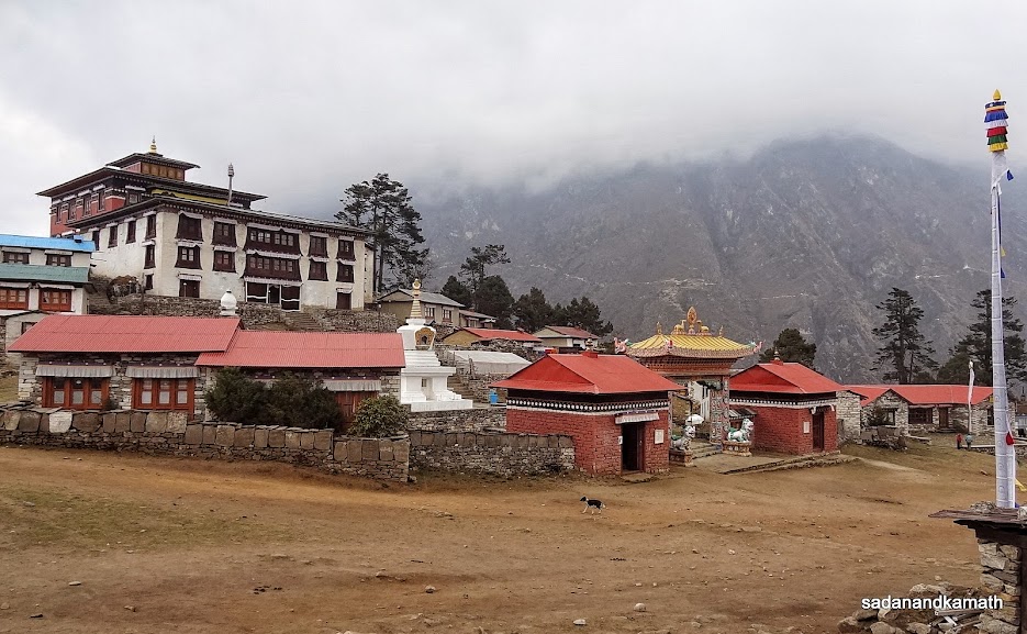
Namche Monastery.
April 28th : Namche Bazar to Tengboche (10 kms), 7 hours.
Namche Bazar (3420m)-Sanasa (3550m)-Phunki Thanga (3250m)-Tengboche (3870m)
The first thing I did after getting up from the bed in early morning was to ask KS as to how he felt about his back ache. His answer was in negative as the pain in his lower back remained the same as in the previous day. So, his joining the trek for our schedule trek to Phortse Thanga was ruled out. We had an early breakfast at around 6.45 a.m. when KS received the phone call from Puru that he should take rest at Namche Bazar and Shrikrishna one of the porters would remain with him. So it was clear that we will have Ram Rai and Rohit during the remaining days of our trek. Shrikrishna was the best among our three porters in terms of leadership and I felt that he would become Guide sooner than expected. So the choice of Puru in selecting Shrikrishna for attending for attending to KS was as per our expected line.
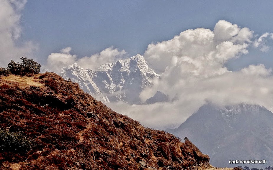
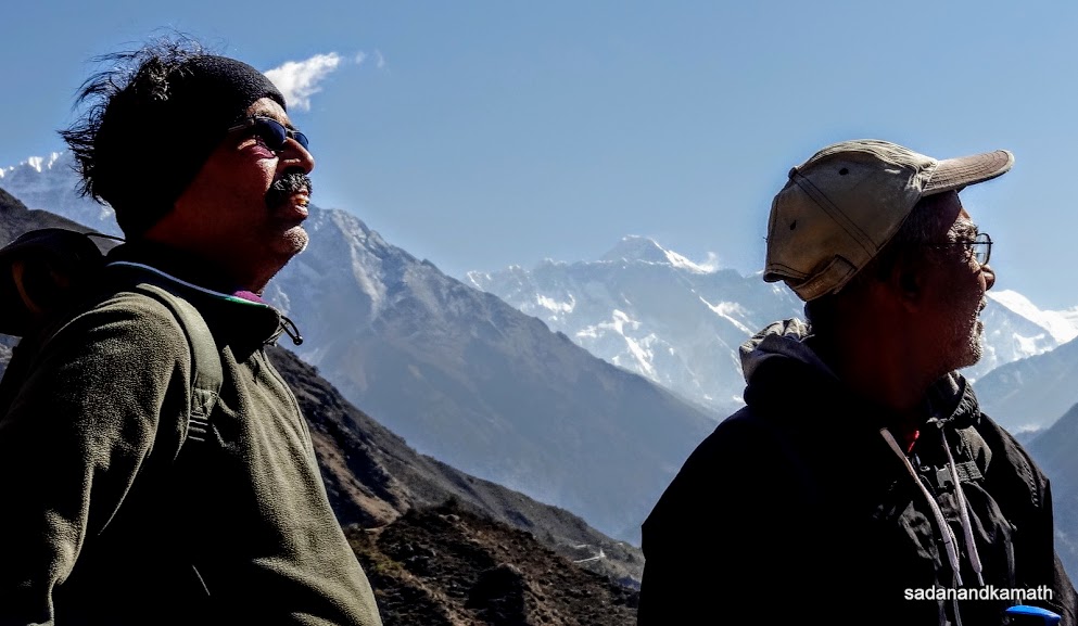
Around 7.30 a.m., myself and PKD departed from Namche Bazar for Tengboche, wishing KS a faster recovery and joining us on the trek after a couple of days, probably at Dingboche where we had a rest day for acclimatisation. This time, Ram Rai took us on somewhat longer route starting from Namche Monastery on the top of Namche Bazar thus avoiding a steep climb from market area. This trail joined at a Chorten where there was a diversion to Everest View Point. The rest of the trail was more or less a plain walk with short spells of climbs and descends up to Sanasa village. The highlight of this part of the trail was that we had uninterrupted views of Mt. Everest, Lhotse and Ama Dablam for more than an hour with a clear sky without haze which was a great thing for the photography. At Sanasa, there were three-way diversions - the trail to the left was for Khumjung village, the straight trail was for Phortse Thanga and the trail to slight right went to Tengboche.
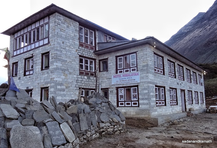
From Sanasa, it was first a gradual descends followed by a steep descends to Phunki Thanga. At this place, TIMS cards were checked and our arrival recorded. Around noon, we had lunch of dal-bhat-tarkari at Losasa very close to Phunki Thanga suspension bridge. After crossing the suspension bridge, it was climbs all the way to Tengboche. Fortunately, the trail was through forest mostly of rhododendron and occasionally, there were some short spells of straigt walk. We reached Tengboche at 3.30 p.m. Since, there were few lodges here, we had sent in advance Ram Rai to book the best of lodges and he did not disappoint us when we checked in Himalayan View Lodge located opposite Tengboche Monastery.
After finishing a cup of milk tea in the lodge's restaurant, I saw from my room window a good looking cafe with bakery products. The urge to eat some bakery products was so great in me that I persuaded PKD to give me company to visit the cafe despite cold and light drizzles. I ordered for an apple pie (NRs.400/-) which was very tasty. We came back to our lodge and noted that most of the trekkers were spending time in restaurant than in their rooms as there were two fire places (yak dung stoves) which kept the restaurant warm. We also decided to spend time in restaurant and this was going to be our routine in the subsequent days in the lodges at high altitudes.
We got the call from our porters for dinner at 7.00 p.m. which was too early for PKD. However, this was going to be the bench mark time for dinner in our all subsequent lodges. At higher altitude, the lodge owners generally close the restaurants quite early. The serving of dinner was unique as we were first given a hot towels to freshen up and spoons and forks were wrapped in a dry towel. With chilly cold in the evening, the hot towel was a blessing in disguise. The food, though expensive, was very tasty.
As I was writing my daily diary before retiring to bed, some stray thoughts came to my mind. First, if KS recovered from back ache, he would not like to venture into uncharted territories all above the 'safe altitude' where, in case of relapse of back pain, he may not have the same facilities as in Namche Bazar. So it made sense to go back to Lukla for Kathmandu and then back home. Second, there was no motivation for him to take risk of pain to join us on EBC route as he had already completed the trek in 2007. Probably, had we continued the trek to Gokyo route, there could be some motivation for him to join us, disregarding the chances of the relapse of back ache on the way. Of course, all these were my conjectures. When the momentum of trek has been lost due to health problems, the first thing a person would think is to have a comfort of home. So I had a feeling that once recovered from the back ache, KS would prefer to return home. With these thoughts, I retired to bed at around 8.30 p.m.
Some pictures of the day below :
 |
Morning view from our room window in Namche Bazar as we leave for Tengboche.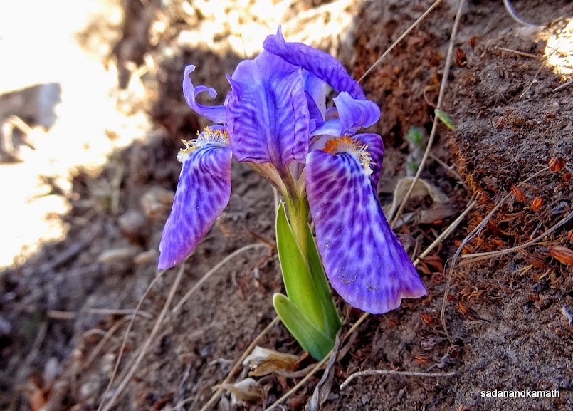 |
Wild flower on way to Sanasa, probably belonging to Iris family.
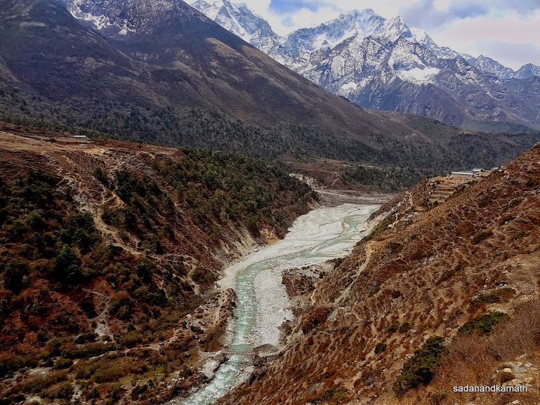
From this point on way to Sanasa, one can see in the valley double suspension bridge over Dudh Koshi river (appearing like two lines) near Jorsalle.
Mt. Everest (left) and Lhotse (right) seen from the trail to Sanasa on way to Tengboche.
Mt. Everest (left), Lhotse (middle) and Ama Dablam (right) on way to Tengboche.
Me and PKD with Mt. Everest (middle) in the background on trail to Sanasa on way to Tengboche.
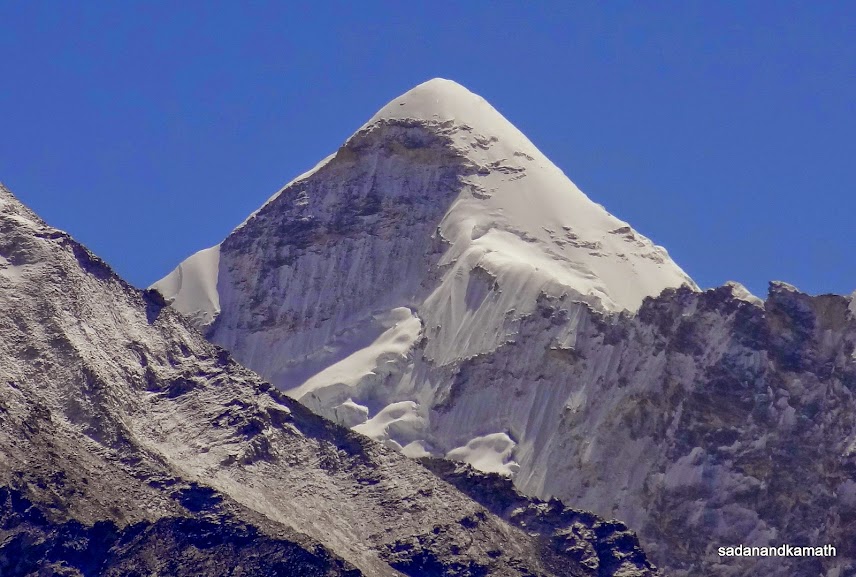
A zoomed shot of Mt. Everest.
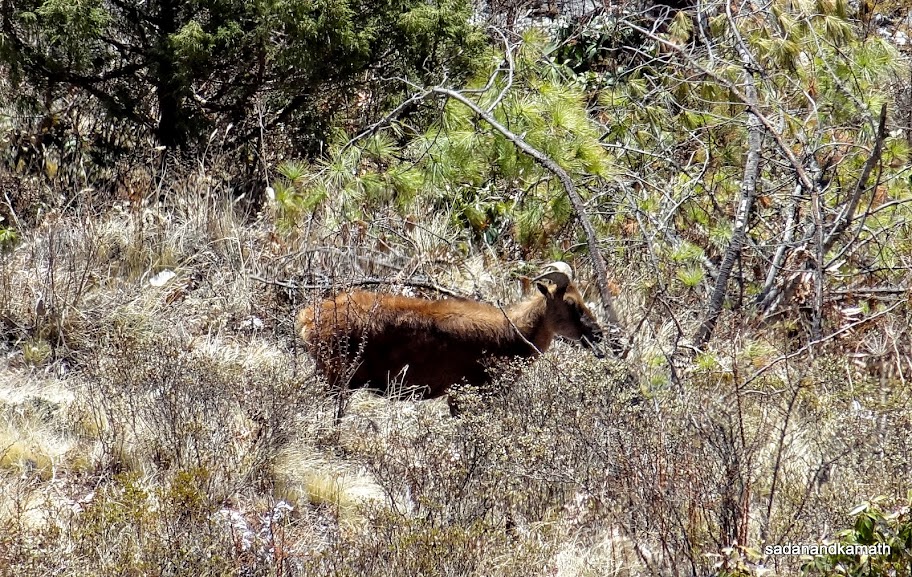
A Himalayan Tahr (Mountain Goat) near Sanasa on way to Tengboche.
A rescue helicopter (in the middle) looks very tiny in the background of Ama Dablam peak.
One of the nicely located restaurants in Khyangjuma on way to Tengboche.
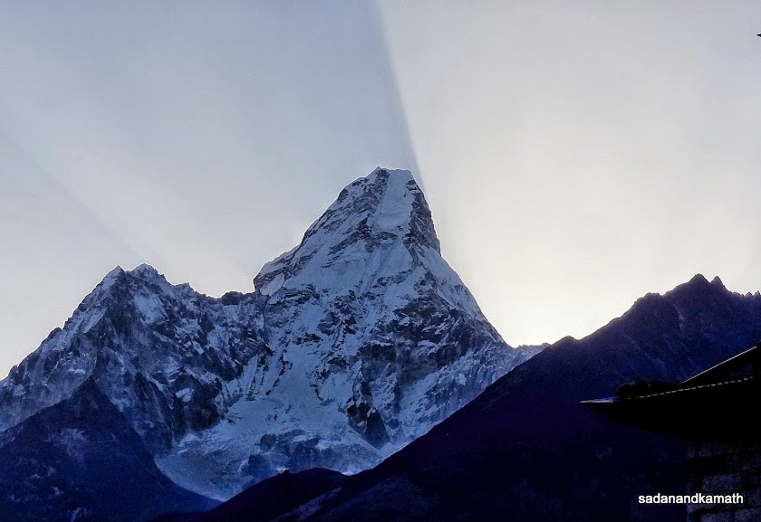
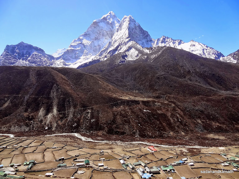
The pointed peak of Kangtega in the middle seen near Tengboche.
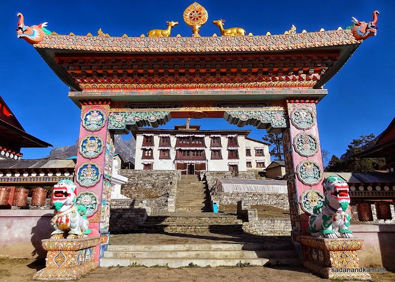
Tengboche monastery which is regarded as one of the largest monasteries in Khumbu.
We stayed in this lodge in Tengboche.
April 29th : Tengboche to Dingboche (10 kms), 6 hours.
Tengboche (3870m)-Pangboche (3960m)-Somare (4040m)-Dingboche (4360m)
As usual, we got up at 5.15 a.m. to a cloudless bright sky. From our room window, some of the snow clad peaks were clearly visible. I went down to take some pictures of snow peaks and realised that some more peaks were also visible from other directions. After an early breakfast at 6.30 a.m., we left Tengboche for Dingboche at around 7.00 a.m. After a gradual descend from the backside of our lodge through forest for about 2 kms, we reached Deboche which many trekkers use for overnight stay in case they are not able to get accommodation in Tengboche. Deboche has a big camping site also. It was one of the tents in Deboche that one Indian trekker in his 30s was found dead in the morning of the previous day as told to us by one of our porters.
The morning was very cold and the forest cover did not help sunshine to percolate on the ground. However, once out of the forest, climbing above the tree line, it became pleasant to trek. After crossing a wooden bridge, a steep climb followed by a gentle climb thereafter led us to Lower Pangboche. There is a ascending trail to the left which goes to Upper Pangboche where one of the oldest monastery is located. After trekking on a mix trails of gentle climbs and some level walks, we reached Somare where we had a lunch break. Post lunch, we crossed a meadow passing through Orsho which had one lodge. There are diversions immeditely after Orsho - Dingboche to the right and Pheriche to the left. We took Dingboche trail.
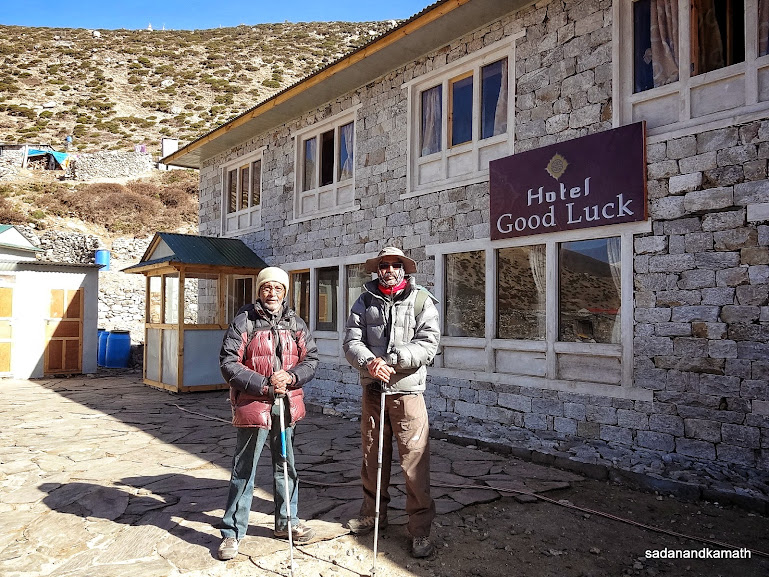
After crossing Khumbu Khola river, a trail of gradual climbs led to a chorten located at the corner of the trail. This signalled that Dingboche was not far off. The sky was suddenly overcast and we could feel some sprinkle of rain falling on us. As we noted on the ground, those were actually small hails. After sometime, hails turned into snow flakes. From the chorten, we could see Dingboche village in the valley. A straight walk followed by a short gentle climb then a short steep descend brought us to the entrance of Good Luck Lodge which appeared to be a newly constructed lodge. As usual, Ram Rai had gone in advance to locate a good lodge and this time also, he succeeded in his finding a good lodge for us.
Although we reached Dingboche at 2.30 p.m., the outside temperature was 5C as per my Sunnto watch which I had kept outside the window to record the temperature. So I would not be surprised, the night temperature may fall below zero. Fortunately, almost all the lodges on EBC route has rooms with thick wood panelling from all sides with wooden flooring, giving some relief from the intense cold in the night.
Some pictures of the day below:
Morning peak views from Tengboche. The peak on the left appears to be a part of Kangtega peak which looks like a horse saddle.
Morning view of Taboche peak from Tengboche.
Morning views of Tengkangboche and Panayo Tippa peaks from Tengboche.
Morning view of Ama Dablam peak from Tengboche with sun rays from its behind.
Front view of Tengboche monastery.
As we trekked away from Tengboche, the monastery looks dwarf in the towering background of Nupla peak.
We have to cross Izma Khola river on a make shift wooden bridge (in the middle) to climb to Pangboche.
Lower Pangboche village with Aba Dablam peak in the background.
Izma Khola river flowing by the side of Pangboche (right). The wooden bridge below (in the foreground) and the trails to the other side of the hill leads to Aba Dablam Base Camp.
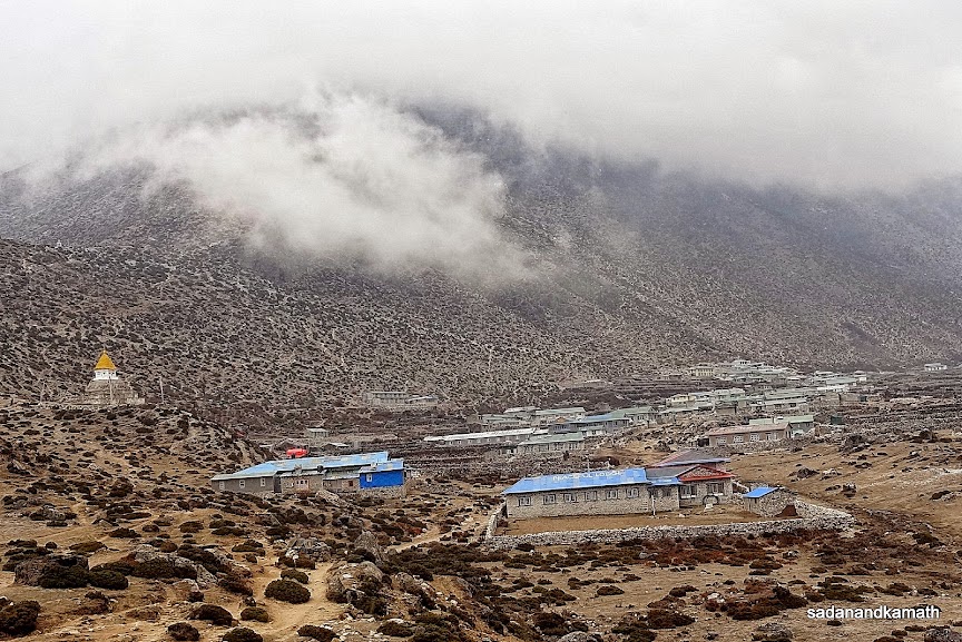
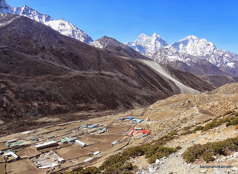
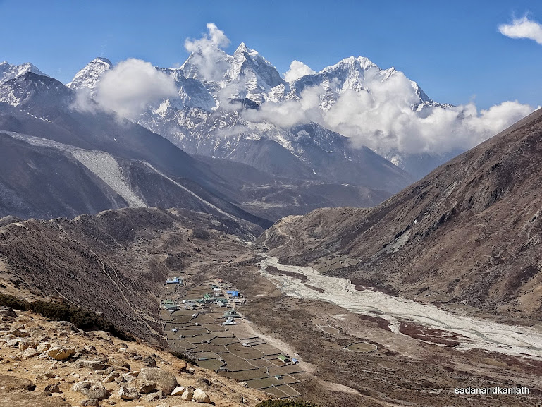
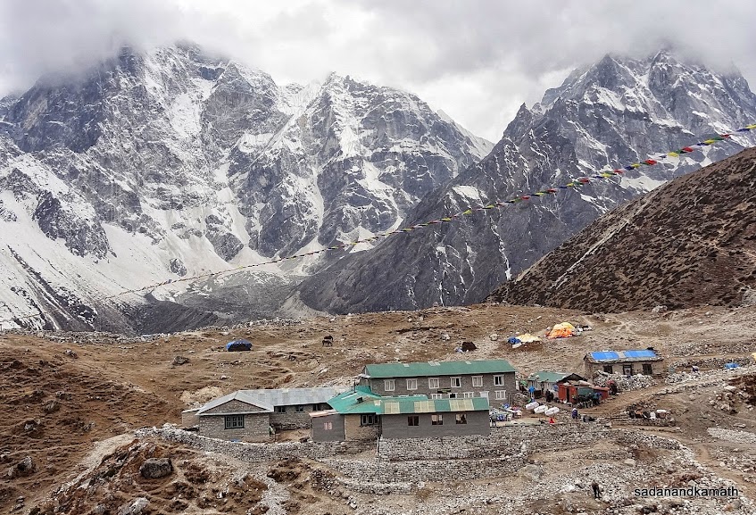
Dingboche (4360m) village.
April 30th : Dingboche Acclimatisation Trek (5 kms), 3 hours.
Dingboche (4360m)- Dingboche View Point (4610m)-Dingboche (4360m)
The early to bed results in early to rise. It happened with us that despite a rest day, we woke up at 5.30 a.m., earlier than what we intended. I checked the room temperature on my Sunnto watch which showed 3C. So the outside temperature must be sub-zero. We could see from our room window that there was good sunshine with clear sky. In fact, we could see Ama Dablam, Kangtega, Taboche and other peaks from our window. So I went out to click the pictures of snow peaks.
At one time we were thinking that there was no need to do acclimatisation trek this time as we had already done only two days back in Namche Bazar. But the problem was what will we do the whole day? We could take a stroll in Dingboche village but that will not take more than one hour to complete.
After the morning tea, a few of the trekkers and their guides and porters were out in the sun for warm up. So we also joined them. One of the guides who was accompanying a Japanese trekker for climb to Island Peak suggested to me that we should not skip acclimatisation trek. In fact, he strongly advocated to go beyond Dingboche View Point (4610m) to a higher view point located on the same ridge at around 5100m. I responded to his suggestion by saying that for me and PKD it would mean a whole day of trek without rest.
After breakfast, we continued to get soaked in sun rays as it was very cold. The clear sky, the good sun shine and peak views prompted us to commence our acclimatisation trek sooner than later. Both Ram Rai and Rohit joined us for the trek to Dingboche View Point. The climb to the View Point started from the entrance of our lodge itself. It was a steep climb with zig zag trail until we reached the lower view point. From this point also we could see many peaks. From here, the climb to higher view point was not that steep but due to higher altitude, climbing became more difficult. I was climbing very slowly, slower than PKD with frequent rests as I would not walk until my breathing became normal.
It took me two hours to climb for an altitude gain of about 250m. The View Point was located on a ridge. The view from this ridge was fantastic. On the one side was Dingboche village in the valley with almost 180 degree views of peaks such as Lhotse, Thamsekru, Island Peak, Cho Pholu, Ama Dablam, Kangtega and some unnamed peaks. On the other side of the ridge was peaks like Taboche, Lobuche on trail to Dhukla/Lobuche. After spending 30 minutes on the ridge, we descended to Dingboche in less than one hour.
After a lunch of boiled rice and mixed vegetable curry, we washed our cloths as the sun rays were very strong. But the prospects of washing in ice cold water restricted my washing to a couple of handkerchiefs and socks. Rest of the day was spent outside in the sun and thereafter in the restaurant around fire place. We returned to our room only after dinner at 7.00 p.m. In the meanwhile, I received a sms from KS that his back ache continued and he was thinking of discussing with Puru for taking helicopter to Lukla and to Kathmandu thereafter. This sealed the prospect of his joining the trek as I expected. After reading his sms, PKD suggested that we may also return home after completing EBC trek without continuing the trek to Gokyo. The suggestion was worth considering as trek to Gokyo was KS's main interest. If KS was not there for this trek, there was no point for us to continue the trek to Gokyo especially when we have been trekking for the last 15 days or so. Moreover, it would take another 7 days to complete EBC trek.
With this pondering point, I retired to bed at around 8.00 p.m.
Some pictures taken during the day below:
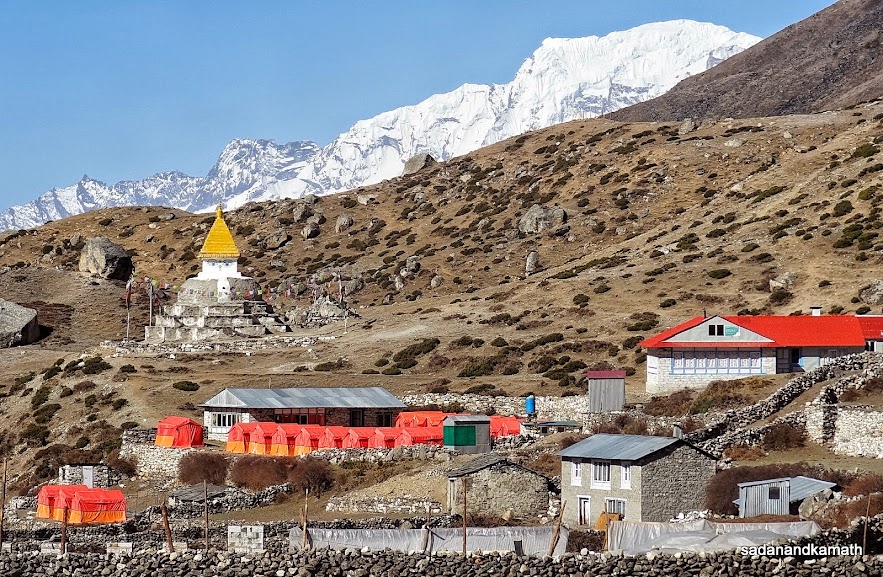 |
Camping site at Dingboche. These tents were still being used by personnel involved in logistic support to now aborted Mt. Everest Expedition-April 2014. In the background is Karyolung peak (6511m). The trail from Tengboche is on the right.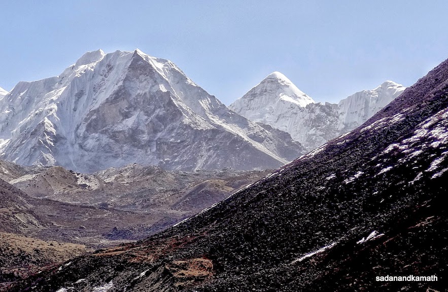 |
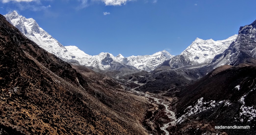
Morning view of Island peak (6117m) and the pyramid shape Cho Pholu (6734m) from Dingboche.
Inching towards View Point Ridge in the middle. Lhotse (8501m) is partially visible on the right.
The View Point ridge (4610m) from where we got almost 360 degree of snow peaks.
View from the front side (left portion) of View Point ridge. Peaks from left to right are Lhotse, Island peak, Cho Pholu, Makalu and Chhukhing among others.
Dingboche village with Ama Dablam (6811m) in the background seen from View Point ridge.
Dingboche from View Point ridge with Kangtega (left) and Thamserku (right) in the background.
Taboche (left) and Lobuche (middle) seen from the View Point ridge. The trail in the middle goes to Dhukla/Lobuche.
Me, PKD and Rohit on View Point Ridge (4610m) with Ama Dablam in the background.
Zoomed shot of Cho Pholu from View Point ridge.
Zoomed shot of Chhukhing (6238m) from View Point ridge.
Me and PKD on View Point ridge (4610m).
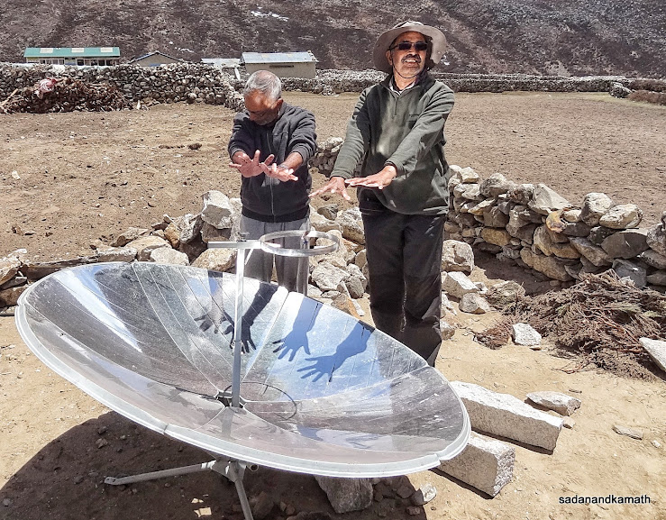
Soon after return from View Point ridge, we warmed up our hands on a sun ray reflector. The heat generated by the reflector was so strong that we had to keep our hands at a distance. This reflector is used for boiling water by keeping the vessel on the stand. We saw water boiled within 30 minutes.
May 1st : Dingboche to Dhukla (Thukla), 5 kms, 3 hours 30 minutes.
Dingboche (4360m)-Dhukla (4620m)
As per the itinerary, we had planned to reach Lobuche (4930m) today. However, I felt that the altitude gain of about 550m in a single day may create some altitude related problems. Also since we had extra days in our hand due to cancellation of our trek to Gokyo, there was no point in hurrying up now. So we had decided in the previous evening that we would trek up to Dhukla today. Spending more time at Dhukla itself would amount to acclimatisation at a higher altitude.
I got up at at 5.30 a.m. and went down to restaurant to brush teeth and to have my morning tea. It was very cold morning but a bright sun shine with a clear sky compensated for the cold. After breakfast at around 7.00 a.m., we checked out from the lodge and departed for Dhukla a bit late at around 8.00 a.m. The normal trail for Dhukla is a steep climb towards View Point ridge which we had trekked yesterday followed by equally steep descend. However, Ram Rai took us on a slightly longer route which joined the trail from Tengboche. The advantage of this route was that both climbs and descends were gradual.
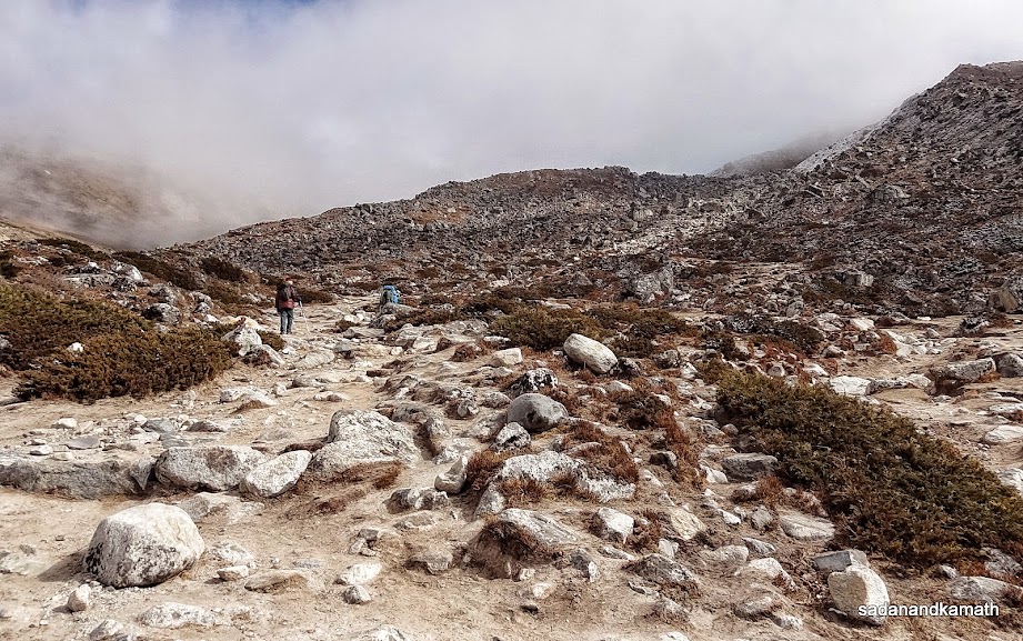
The trek to Dukhla is not physically demanding. After a gradual climb of about 1 km on a longer route, rest of the trail was more or less on a straight path except some short climbs and descends. But at 4500m+ altitude, the reduced level of oxygen in the atmosphere makes walking even on a plain path difficult as at about every 20 steps, there is pressure on the lungs resulting in breathlessness. The panacea for this problem is to walk very slowly even on the plain path and take rest as and when one is short of breath until regaining the normal breathing.
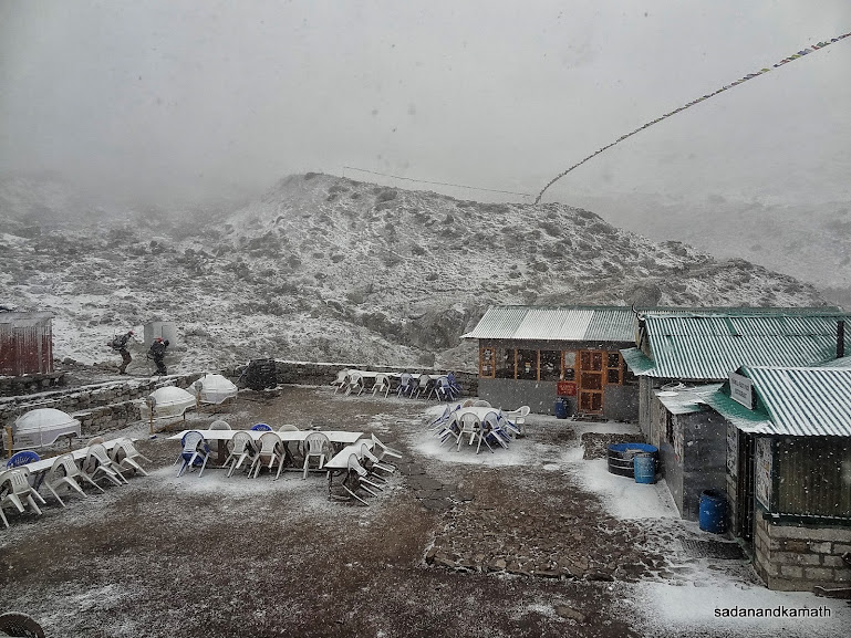
Although we were trekking bereft of greenery, the snow clad peaks such as Ama Dablam, Kangtega, Thamserku, Taboche and Lobuche gave company to us. Pheriche village was seen in the valley from the high plateau from where we were trekking towards Dukhla. We had to climb the last part of the trail before Dhukla on the moraine. After crossing a wooden bridge over a small stream (probably coming from Khumbu glacier hidden below moraine), a small climb led us to Dhukla. I could see only 2 lodges in Dhukla. We checked in the better of the two lodges namely, Yak Lodge at 11.30 a.m.
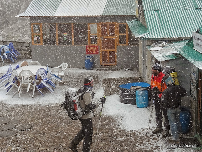
After resting in the room for about 30 minutes, we came down to the restaurant and found that it was almost fully occupied by trekkers. Dhukla is a lunch break point for most of the trekkers who prefer to go to Lobuche for the overnight stay. I had a lunch of garlic soup and omellete as it would have taken more time to get our usual lunch menu of rice and vegetable curry. As we were resting in our room, the sky became overcast and suddenly it started snowing. The light snow showers gradually turned into full fledged snowfall. The open restaurant which were full of trekkers a short while ago looked deserted. Some trekkers who had gone beyond Dhukla returned to Dhukla. After about one hour of snowfall, the weather cleared. We came out of our room and rushed to the restaurant to warm up against the yak dung stove. The restaurant was crowded as due to snowfall many trekkers had decided to stay overnight here. Almost all of them remained in the restaurant until their dinner time.
We met two trekkers from Mumbai who had come from Lukla for EBC trek. They had come from Pheriche. One of them looked depressed as he was not feeling well. After sometime, he came to me and told his problem for a solution. He had breathlessness while trekking from Pheriche. In fact, he wanted to return to Pheriche as he could no longer walk. However, his guide had told him that he had no option as going back would be as problematic to him as reaching Dhukla. Somehow, he managed to reach Dhukla. Now his worry was how he could manage to reach Lobuche the next day when he found it difficult to walk at a lower altitude of Pheriche-Dhukla. He had also a mild headache.
I noted that while talking to me, his breathing was normal. After talking to him for sometime, I found that his friend with whom he had come for EBC trek was a fast trekker and he would be so much ahead of him while trekking that he would not be visible for him. This had put what is called a 'peer pressure' on him making him to trek faster than his normal pace. In high altitude this action was bound to make him not only breathless but also exhausted resulting in fatigue. I told him to walk very slowly and do not make his friend's trekking speed as benchmark. Since he has his own porter, he would always be available. So there was no need to walk at a faster pace. I also advised him to take frequent rests as when he felt breathlessness and starting walking only after regaining his normal breathing. The next morning he met me over the breakfast and told me that he was feeling very good and his head ache has completely vanished. He told me that he would follow my advice during the day's trek to Lobuche. I hope he had successfully completed EBC trek.
Then there were four Japanese, all in the age group between 70 and 75 years. They had come from Lukla for climbing Lobuche peak (6120m). As I later met two of them in Pheriche, while two of them successfully climbed the peak while other two returned to Phriche on health reasons.
After an early dinner at 6.00 p.m.of Rara Noodle soup (soup with mixed vegetables and noodles), we retired to beds around 7.30 p.m.
Some pictures of the day below:
Ready to depart from Dingboche to Dhukla (Thukla).
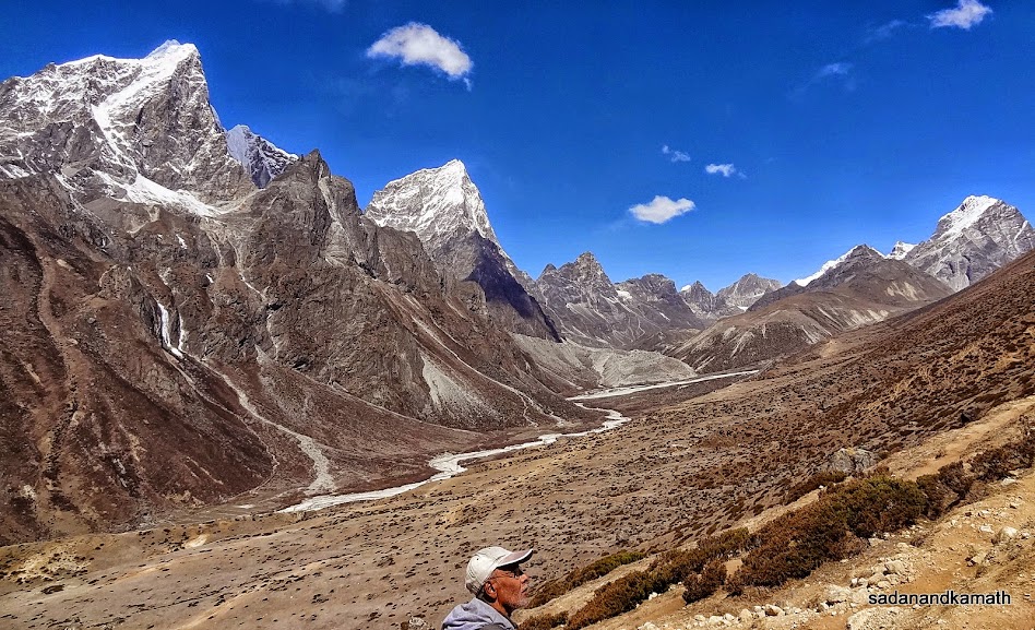
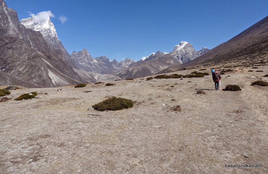
After crossing the ridge, it was mostly a plain walk with short climbs and descends to Dhukla. But the low level of oxygen make even a plain walk difficult. On the left is Taboche peak. The plateau looks dry now but in July-August it is full of wild flowers as told to me by porters.
Some trekkers, mostly foreigners seems to enjoy the rugged landscape. Kangtega peak in the background. On the right side in the valley is Pheriche village (not visible in the picture).
Pheriche village in the valley seen from upper trail from Dingboche to Dhukla. The lower trail through Pheriche goes to Tengboche via Pangboche. Kangtega and Thamserku peaks in the background are partially covered by clouds.
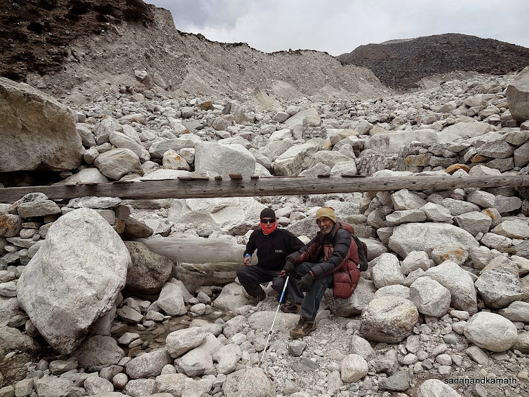
It would appear that PKD and Rohit are sitting on some boulders below a wooden bridge just one km short of Dhukla (4620m). Actually, they may be sitting on Khumbu glacier and the movement of glacier in summer over years has brought on it the moraine through landslides.
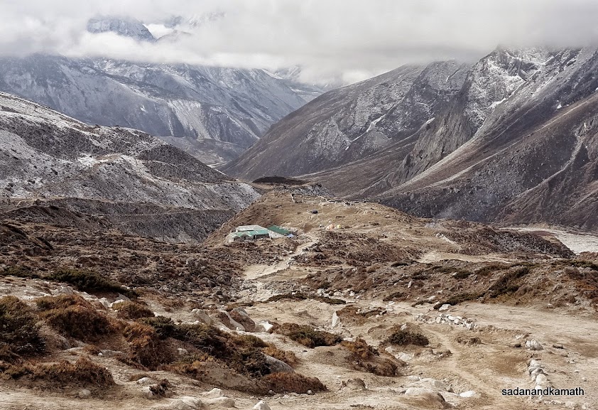
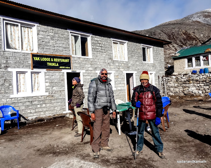
Dhukla (4620m). The lodge with green roof is the Yak Lodge where we stayed.
These two wild fowls (or female Monal?) were seen opposite Dhukla lodge.
Snowfall in Dhukla as seen from my room window.
A few trekkers who had gone beyond Dukhla returning to Dhukla due to snowfall.
May 2nd : Dhukla to Lobuche (5 kms), 3 hours 30 minutes.
Dhukla (4620m)-Dhukla Pass (4830m)-Lobuche (4930m)
I woke up at around 5.00 a.m. and saw from the window an overcast sky with hanging clouds and mist. It was for the first time during our last 15 days trek that I have seen bad weather in the morning. As went down to brush my teeth, I found that water kept in a plastic container had become solid ice. So outside temperature must be sub-zero. Luckily, PKD had ordered a flask of hot water in the previous night which became handy now to freshen up.
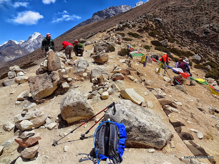
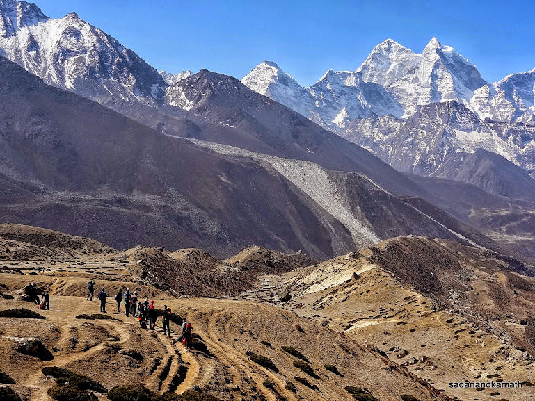
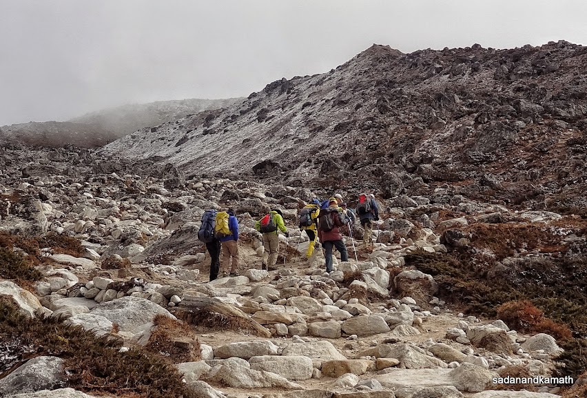
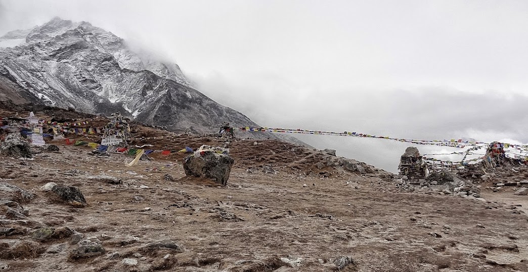
After a breakfast of porridge and boiled eggs, we were ready to depart for Lobuche at around 7.00 a.m. But PKD was apprehensive about the cloudy weather especially after the snowfall in the afternoon of the previous day. After waiting for about 45 minutes, rays of sun came out of the cloud bring a ray of hope of an improvement in weather. In no time, the hanging cloud and mist got cleared. At last, we departed from Dhukla at 7.45 a.m.The trail to Dhukla Pass was a gradual climb but both of us found this climb extremely exhaustive as we were required to rest quite often. Even after reaching Dhukla Pass, it took me about 5 minutes to regain my normal breathing after which I could drink water and take some pictures. There were stone memorials in the memory of all those who lost their lives while climbing Mt. Everest. Because of the cloudy weather we could not get the peak views. There was a trail to the left on the ridge which goes to Gokyo via Chola Pass (5388m). The trail to the right goes to Lobuche.
After the pass, the trail was mostly short climbs and descends on the true right side of a stream to reach Lobuche. As usual, I had sent Ram Rai in advance to look for a good lodge. This time, he was not successful as almost all good lodges were booked in advance by the trekking agencies. So we had to satisfied with National Park View Lodge, one of the old lodges with basic facilities, located at the start of the village.
After some rest in the room, we ordered for boiled rice and egg curry. The lunch was an average affair. After one hour of post lunch siesta, we went down to the restaurant for tea and thereafter we sat down around yak dung stove of the restaurant for warm up with some Israeli trekkers. One of them was to go to Gokyo via Chola Pass. We all sat around the stove until dinner at 6.30 p.m. This time, we had Rara Noodle Soup which was good.
Somewhere on the way, I received a SMS from KS informing me that he had reached Kathmandu via Lukla and waiting to board 2.00 p.m. Indigo flight to Delhi and then to Mumbai. We had no idea as to how he reached Lukla until we got another SMS after a couple of days. But that is a different story.
Some pictures of the day below:
 |
As one can see weather has improved in Dhukla (Thukla) and we are about to proceed to Lobuche.
 |
Taboche peak is unveiled as cloud and list clears over Dhukla.
Climb towards Dhukla Pass (4830m). A desolated place devoid of any scenic beauty to cheer us as we slowly walk towards the pass.
Looking back at Dhukla (green roofs). The previous day's snowfall has changed the colour of surrounding mountains from brown to grey.
The weather is once again turning dicey as trekkers negotiate the boulders. On the ridge is Dhukla Pass.
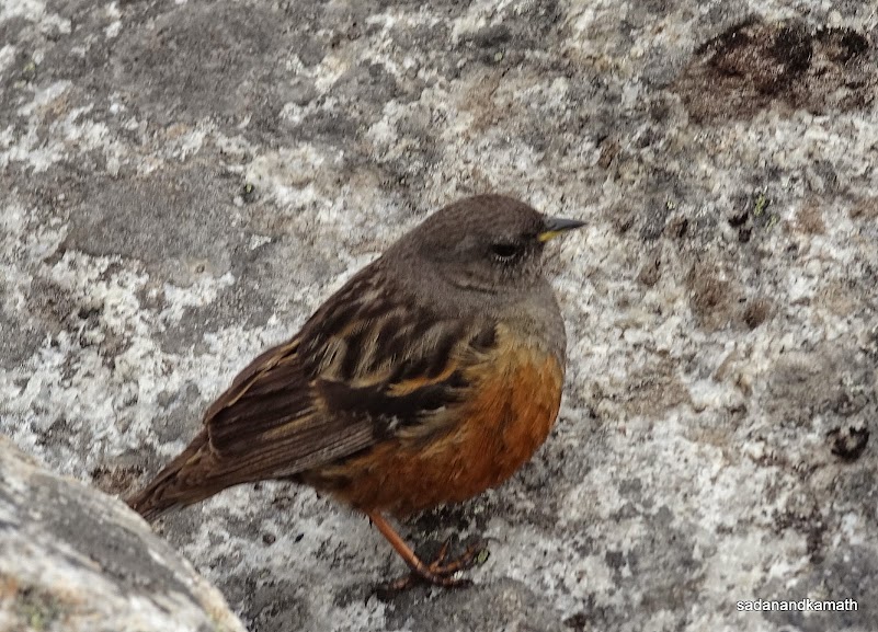
An unidentified bird (probably a Himalayan Sparrow) near Dhukla Pass (4830m).
On Dhukla Pass (4830m). The person in green jacket is a businessman from Navi Mumbai. He had come to Nepal on a business trip after which he decided to trek EBC. He said that after completion of EBC trek, he would take a Helicopter ride to Kathmandu from Gorakshep as he does not want to repeat the trek on return.
The stone memorials in remembrance of those who lost their lives on Mt. Everest expeditions.
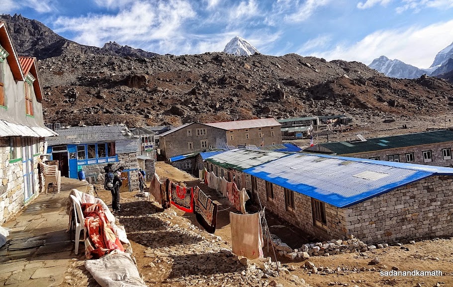
Lobuche (4930m).
Next Blog : Part-3 : Lobuche-Phaplu-Kathmandu (under construction)
1 comment:
Great detailed report and pictures!
Post a Comment