Day-5
The morning in Maple Pine was a repetition of the previous morning - lot of dews on the ground, fog and cold. The early morning temperature at around 8 degree Celsius was better than yesterday's 4.9C. A lot of dews in the morning with fog gave us some comfort in that generally, these were the indicators of a good weather during the day.
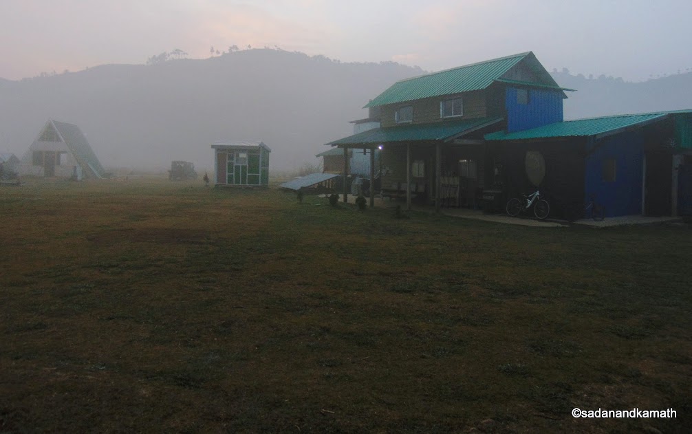
Early foggy morning at Maple Pine Home Stay.
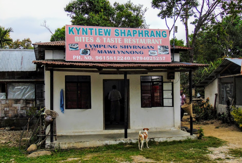
Today, we have quite a busy day as we would be moving through Cherrapunjee tourist circuit and end the day in our roosting place, Sai-Mika Resorts in Cherrapunjee. After the bath, we hurried up for the complementary breakfast at around 7.30 a.m. We left Maple Pine around 8.30 a.m. and started the car journey about 9.00 a.m. from the road. After driving for about an hour, we crossed the Dympep bridge on Shillong-Cherrapunjee road. Mawkdok Dympep Valley view point is located immediately after crossing the bridge.
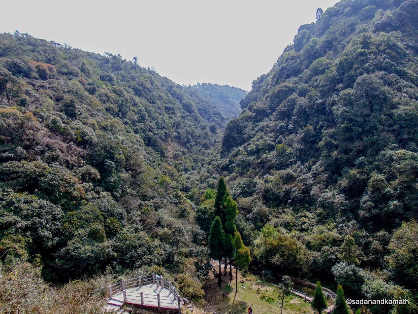
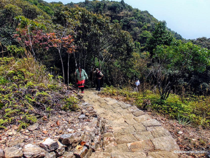
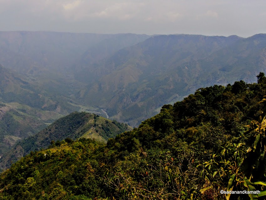
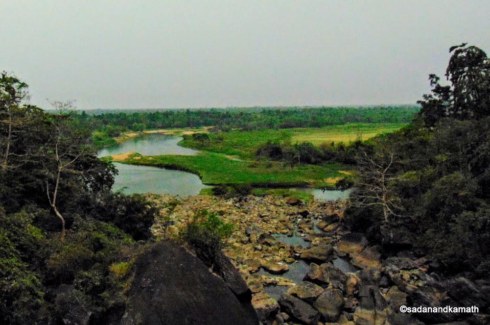
1. Mawkdok Dympep Valley : From the arch of the gateway to Mawkdok Dympep Viewpoint, one has to descend about 300 cemented stairs. For those who are unable to walk on the stairs, they can view the valley from the left side of the road though the view would not be as great as that from the Viewpoint. Those who are taking the stairs, again have two options - on half-way to the descend, there is a gallery for viewing the valley. The last viewing gallery gives a grand stand view of the valley.
There are shops on the right side of the road selling local handicrafts and some quick snacks. At the end of the shopping lines is a clean toilet which I first thought to be a curio shop from the distance.
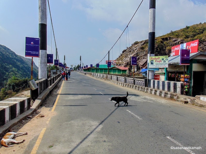
Cherrapunjee tourist circuit starts after crossing this Duwan Sing Syiem bridge.
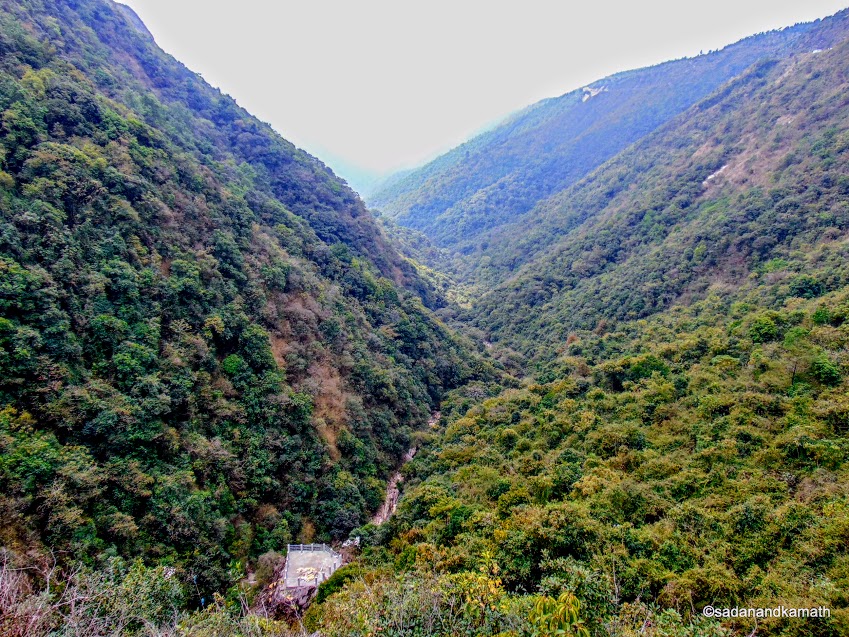
Dympep Valley view from the road bridge.
Valley view from the intermediate viewing gallery. The last viewing gallery can be seen at the bottom of the picture.
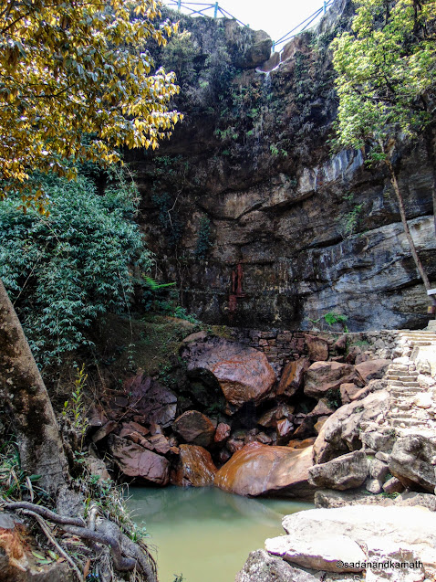
2. Garden of Caves : A drive of about 18 kms on Cherrapunjee road brought us to Laitryngew village. A right turn from the main road and a 2-km drive led us to the gate of the Garden of Caves (Ka Bri Ki Synrang). It is a privately owned tourist spot. Entrance fee for the Garden of Caves is Rs.30/- per head.
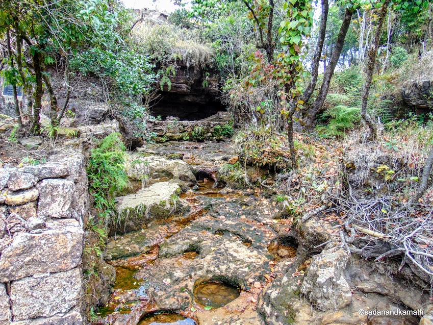
After the entrance, a cave is located on the left where a big flat rock slab by the side of the wall is named as King's bed. A smaller rock flat slab by the side of the first one has been named as Queen's bed. A further walk in the cave leads to a point where there is a round hole on the roof of the cave from where water drips in the cave to form a very small pond. In rainy season, this becomes an unique waterfall inside the cave as water flow rapidly from all sides of the roof hole making a thick vertical waterfall.
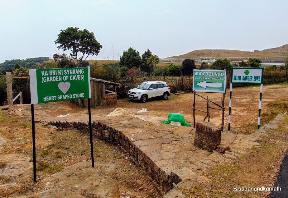
Entrance to the Garden of Caves.
Inside the Garden of Caves.
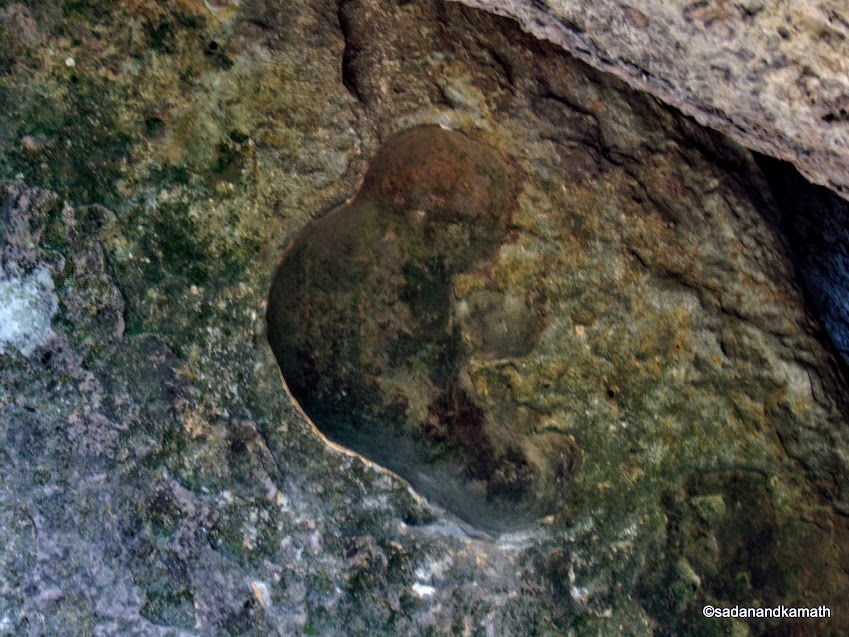
These are supposed to be the foot prints of some pre-historical animals.
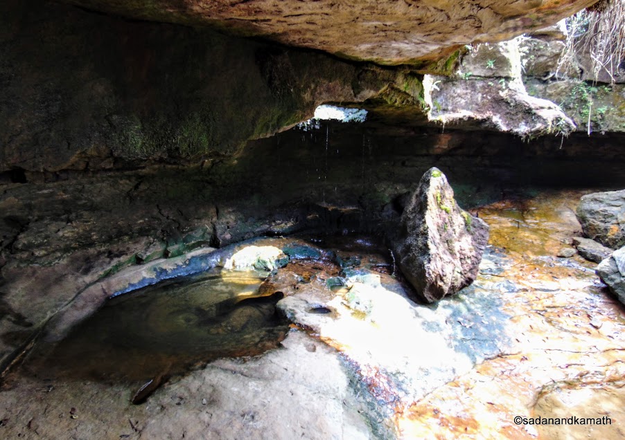
The waterfalls has reduced to a tickle. Water flows through the hole on the roof of the cave during rainy season.
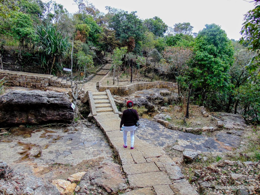
The are 3 other waterfalls inside the Garden of Caves premises. However, due to dry season, the waterfalls have been reduced to tickles. Then, there are other 'wonders' on the rocks such as an heart-shaped small waterhole and a natural rock cut resembling that of a child in the womb. The Garden of Caves involves a moderate climbs and descends on the stone stairs especially for visiting the waterfalls.
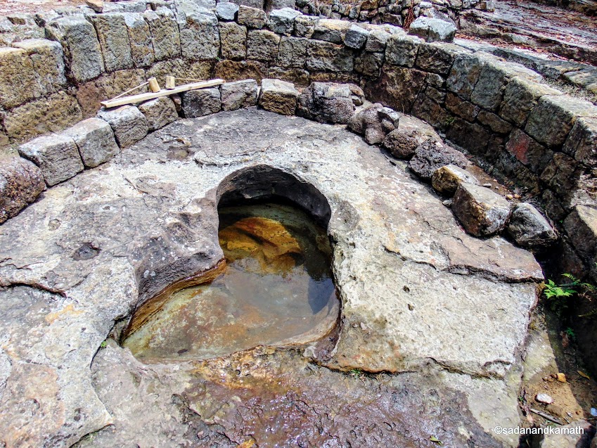
A heart shaped mini pond.
The second waterfall inside the Garden of Caves has also reduced to a tickle.
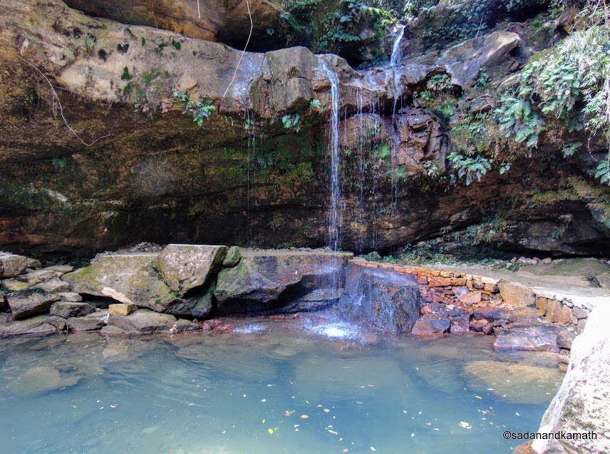
Third waterfall has some semblance of being called waterfall.
The cut-out in the rock in Garden of Caves resembles that of a child in the womb.
The end of the Garden of Cave Tour.
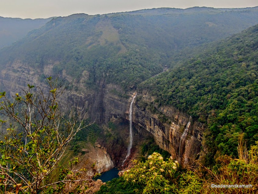
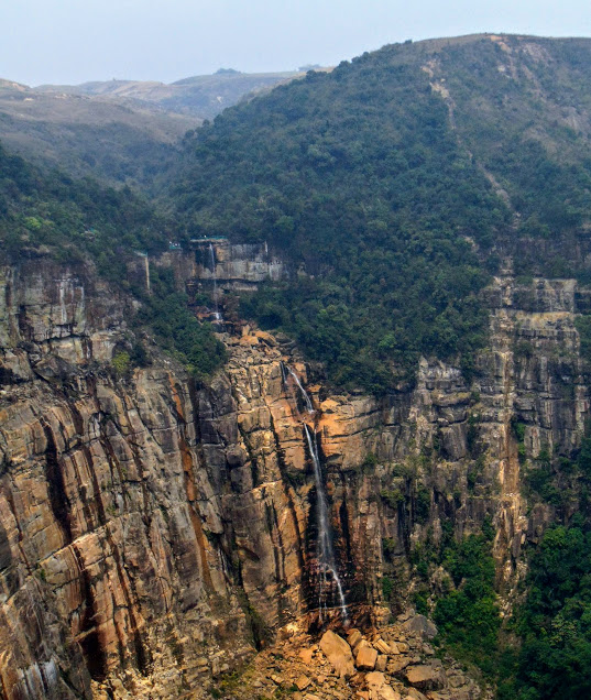 Seven Sisters' Waterfalls, Nohsngithiang. In dry season, only one waterfall is visible.
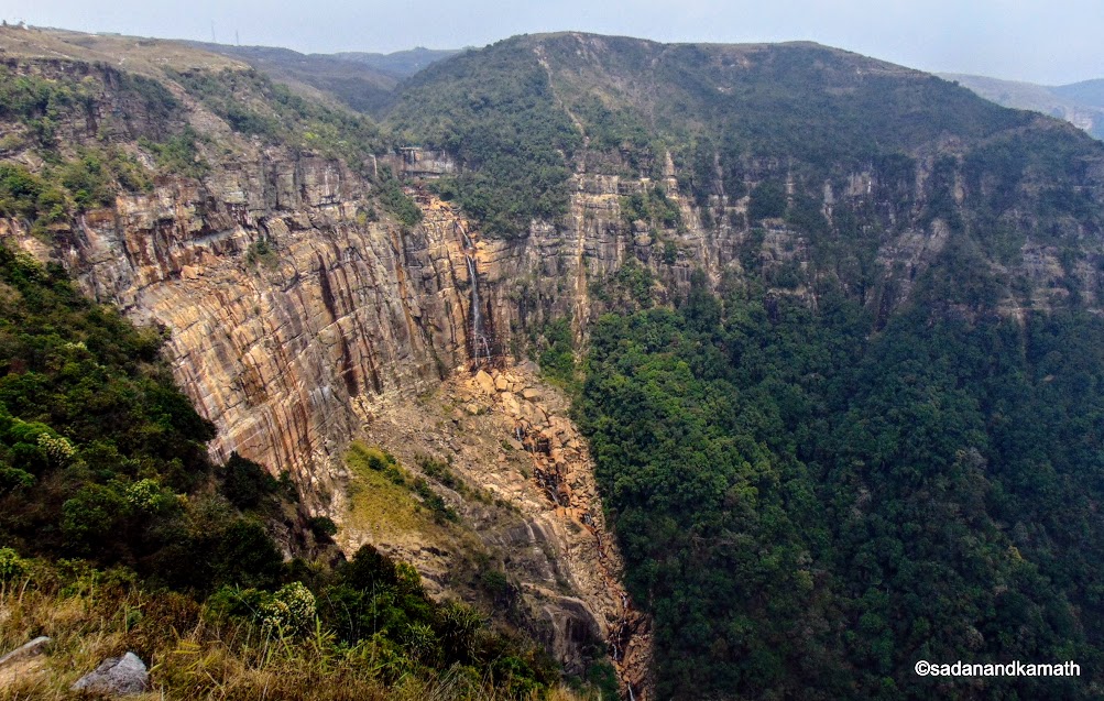 A long shot of the Seven sisters' Waterfalls. One can imagine how long is this waterfall.
 Lunch break at this place.
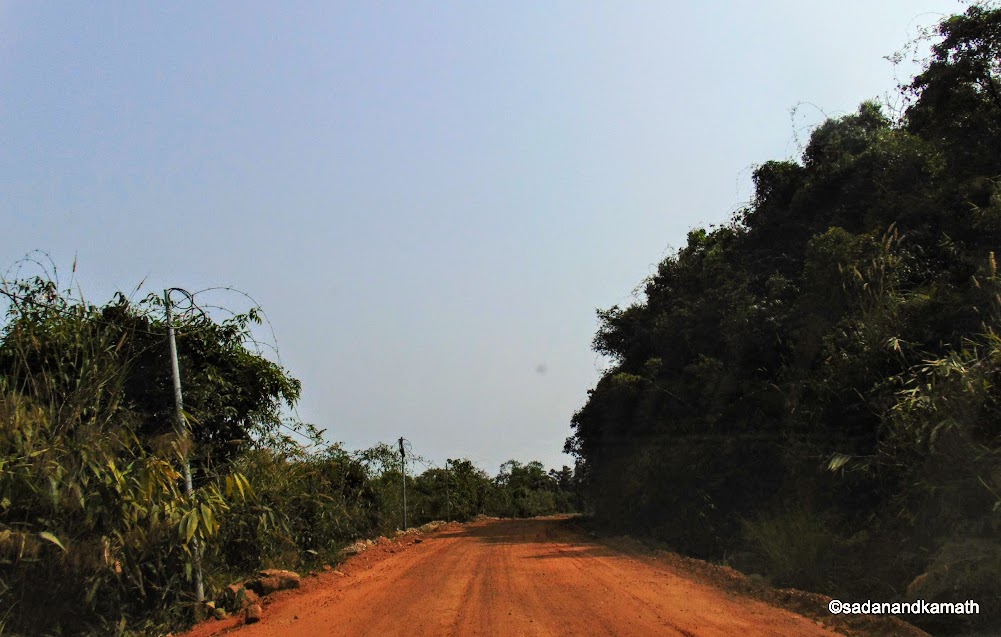 Two lane mud road to Ka Khoh Ramhah (Pllar or Conical Rock).
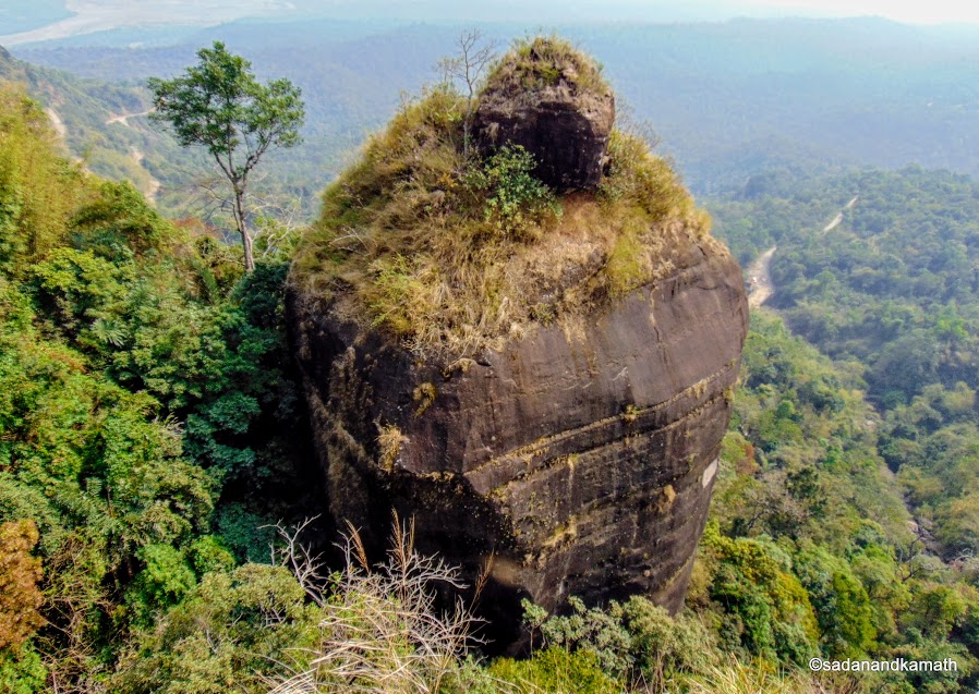 Ka Khoh Ramhah - Monolith rock in the shape of a Shivling. Bangla Desh plains are visible behind the rock.
3. Seven Sisters Waterfalls : A 18-km drive from the Garden of Caves on Cherrapunjee road brought us to Seven Sisters' Waterfalls Viewpoint. Being a dry season, only one waterfall out of seven was visible. The waterfall may be the longest in Cherrapunjee region as we could not see the bottom of the waterfall where it ended to become a stream. I could see disappointments looming large on the faces of most of the tourists. But we were aware of the fact the best season to watch waterfalls in Meghalaya was during September-October when the monsoon would be on the wane but water flow would be sufficient to make them awesome to watch.
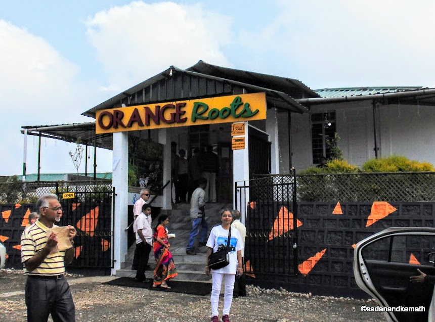
From Seven Sisters' Waterfalls, Mawsmai Cave was very close by. However, Pradeep suggested that we could visit the cave in the evening when the day-tourists would be heading back to Shillong making the cave less crowded. We headed for lunch at Orange Root which is located about 8 kms north of the Seven Sisters' Waterfalls on Cherrapunjee road. Instead of thali lunch, we ordered for South Indian snacks which we had not eaten since we left home. The food was tasty and the restaurant ambience was very good. We could see Ramkrishna Mission Asharam on the opposite side of the valley.
4. Ka Khoh Ramhah (Giant Conical Rock) : After lunch break, we moved further south on Cherrapunjee-Shella road for visiting Ka Khoh Ramhah (Giant Conical Rock). Almost half of 14 kms of drive was on the two lane mud road. It appears from the parking of road rollers and tar-lying machines that this road would become a tar road, probably before the start of the coming monsoon.
There is no entry fee for viewing the giant conical rock but car parking fee of Rs.20/- was collected from us. There is a viewing gallery to see the monolith rock admeasuring about 200ft tall in the shape of a Shivling. One can also view the Bangla Desh plains beyond the monolith rock.
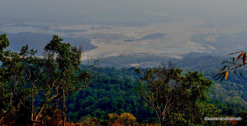
View of the Bangla Desh plains from the Pillar Rock Viewpoint.
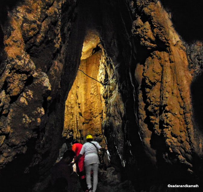
5. Mawsmai Cave : In Meghalaya, there are many caves. In Cherrapunjee itself there are 3 caves on the tourist circuit. We had already seen Mawjymbuin cave two days back but we did not explore it as we felt it was difficult to negotiate. Mawsmai Cave was supposed to be the easiest among the three to walk through and it was fully lighted.
A drive of about 8 kms from Ka Khoh Ramhah brought us to Mawsmai Cave. The place was still crowded though we reached here around 4.00 p.m. The entrance fee is Rs.30/- per head. A wide opening at the cave gave us some comfort. However, once we were inside the cave, the path became narrow. At one place, it was difficult for us to move in a narrow passage with low ceiling. We had to virtually slide on the rock. Other than this, we had more or less the smooth walking. Of course at some places, we had to mind our heads. The lighting in the cave did help us to avoid the collusion with the hanging rocks. Only about 150 metres of walk in the cave is open to the public with entry and exit on the a different sides.
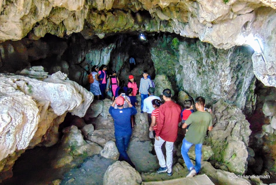
Mawsmai Cave entrance.
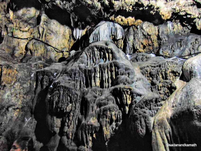
The ;natural sculpture on the wall of the cave made over the years by rainwater seeping through the ceiling of the limestone cave.
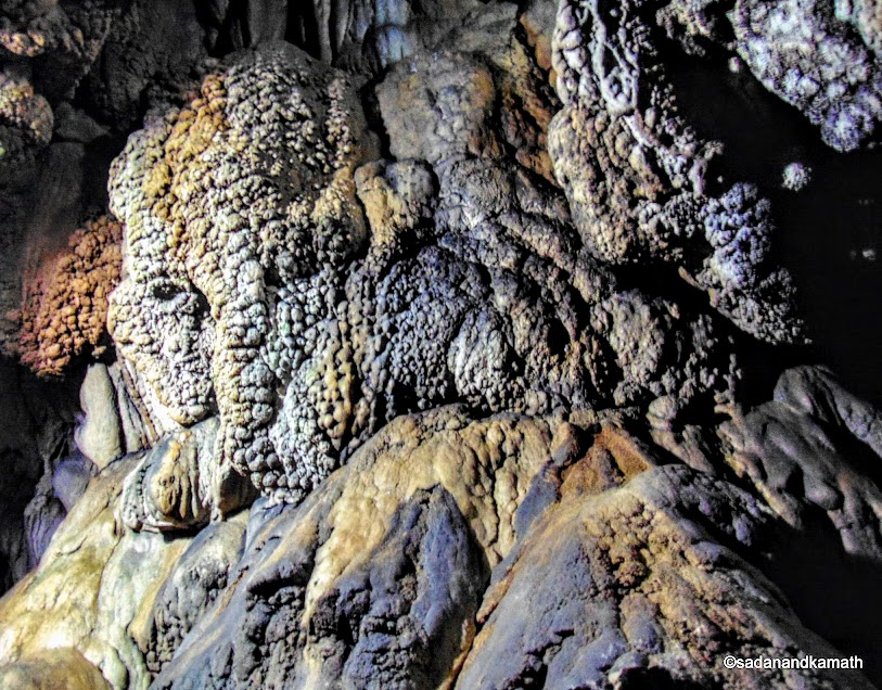
Stalactites formation in Mawsmai Cave wall.
Inside Mawsmai Cave. It is a well lighted cave.
6. Ramkrishna Mission Ashram & School : The weather had become cloudy by the time we reached Ramkrishna Mission Ashram and School which was about 8 kms of drive. On the first floor, a tribal cultural museum was located. We took a round of the museum which was more or less a re-run of some of the items displayed at Don Bosco Museum. Since, we were keen to end the day's programme by visiting Nohkalikai Waterfalls before the close of the timing, we hurriedly drove towards the waterfall.
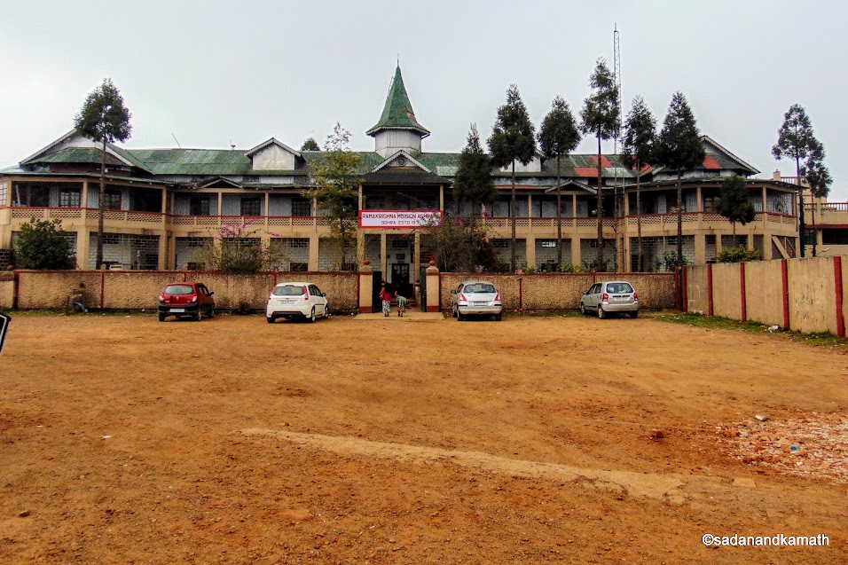
Ramkrishna Mission Ashram and School, Cherrapunji.
7. Nohkalikai Waterfalls : The drive of about 4 kms from Ramkrishna Mission Ashram to Nohkalikai Waterfalls is mostly on the table top. The entry fee is Rs.10/- per head and Rs.20/- as the camera fee. The waterfall looked like one of the tallest waterfalls so far I have seen in India. Due to dry weather, the waterfall was not very impressive though the pool of pond created by the waterfall looked good in light blue colour. Judging by the number of shops selling handcrafts and curios at the viewpoint, this must be one of the popular tourist sites in Cherrapunjee.
Nohkalkai Waterfalls, Cherrapunjee.
A 20 minutes drive from Nohkalikai Waterfalls brought us to Sai-Mika Resorts for our night shelter. Just as we were settling down in our cottages after check-in, thunder and lightening started vigourously followed by heavy rains. The power went off from the Resorts. Fortunately, alternative lights, one each in room and the bathroom were available thorugh the solar power. We had planned to take dinner at the Resorts restaurant but in the absence of light, that option was ruled out at least for now. The Supervisor assured us that he would make arrangements to serve us dinner in our rooms. Fortunately, after sometime, rains stopped and the power was restored. We had dinner in the dinning room at around 9.00 p.m.
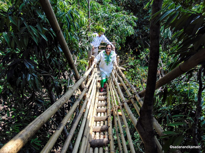 On the bamboo ladder to reach the Tower-1 to view Bangla Desh plains.
Day-6
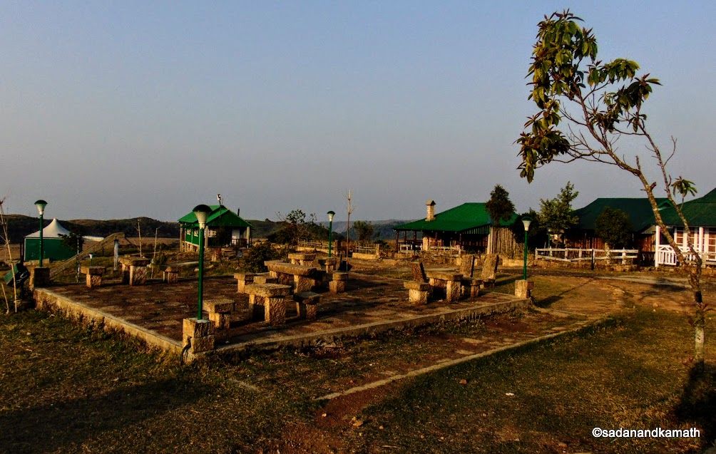
It was a very pleasant morning with clear blue sky. Since we had checked in the previous night, we had no idea as to how the Resorts looked like. Now it was clear that the Resort was located on a plateau having ample open space to take a brisk walk in the morning. There are badminton, tennis and basketball courts, children's play area. The Resort is located about one km away from the main Cherrapunjee-Shella road.
It was a very pleasant morning with clear blue sky. Since we had checked in the previous night, we had no idea as to how the Resorts looked like. Now it was clear that the Resort was located on a plateau having ample open space to take a brisk walk in the morning. There are badminton, tennis and basketball courts, children's play area. The Resort is located about one km away from the main Cherrapunjee-Shella road.
Sai-Mika Resorts, Cherrapunjee where we stayed.
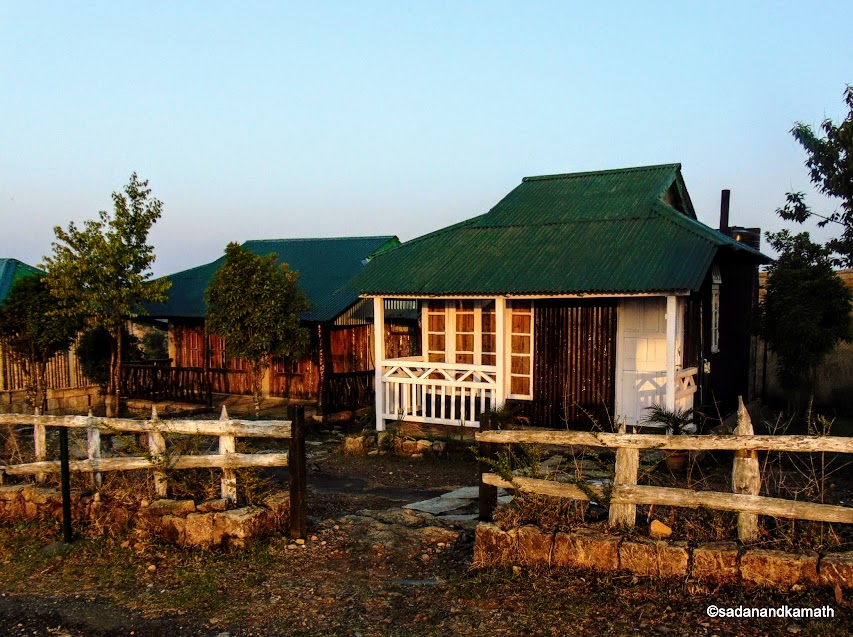
The two cottages of Sai-Mika Resort we stayed.
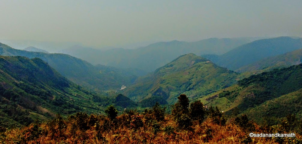
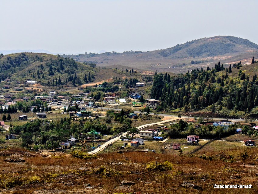
1. Mawkhong Valley View : After breakfast, we left Sai-Mika Resort at around 8.30 a.m. We drove towards north on Shillong road. At Laitlygkot, we took right turn to drive on Mawlynnong road. The road journey was scenic. After driving for about 40 kms, we stopped to take a breath taking view of Mawkhong Valley. The valley is long and wide I fet it worthwhile to spend some time admiring the valley view.
Since it was Good Friday, most of the shops and restaurants were closed on the road side. It was already almost noon and we had not taken any tea break which we usually take in around 11.00 a.m. At last, at Mawshun village we got a good restaurant on the road side. It had a clean wash room. We had the best tea of this trip in this restaurant. We saw some tourists taking vegetarian lunch in this restaurant.
Mawkhong Valley view from Shillong-Dawki road.
Mawkhong Valley view from another angle.
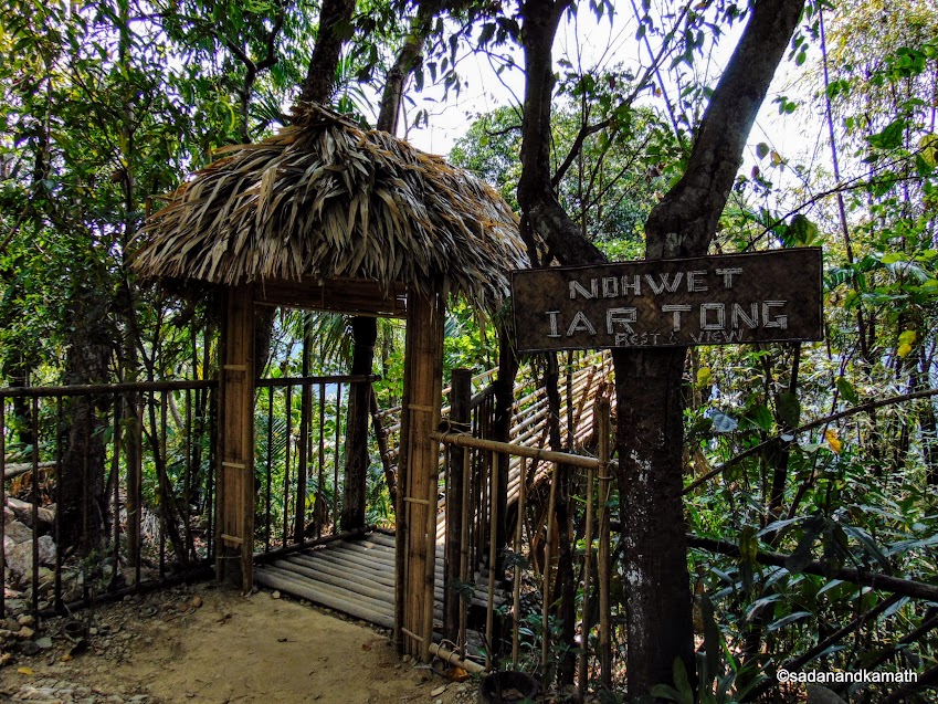
2. Nohwet Viewpoint : Our next destination was Nohwet Viewpoint from where one can have the views of Bangla Desh plains on a clear day. We continued to drive on Dawki road. The road condition was excellent. At Pongtung, we took a right turn to take the village road to Riwai from where a left turn took us to Nohwet Viewpoint. On the way, we got a beautiful view of a village which I forgot to note down the name.
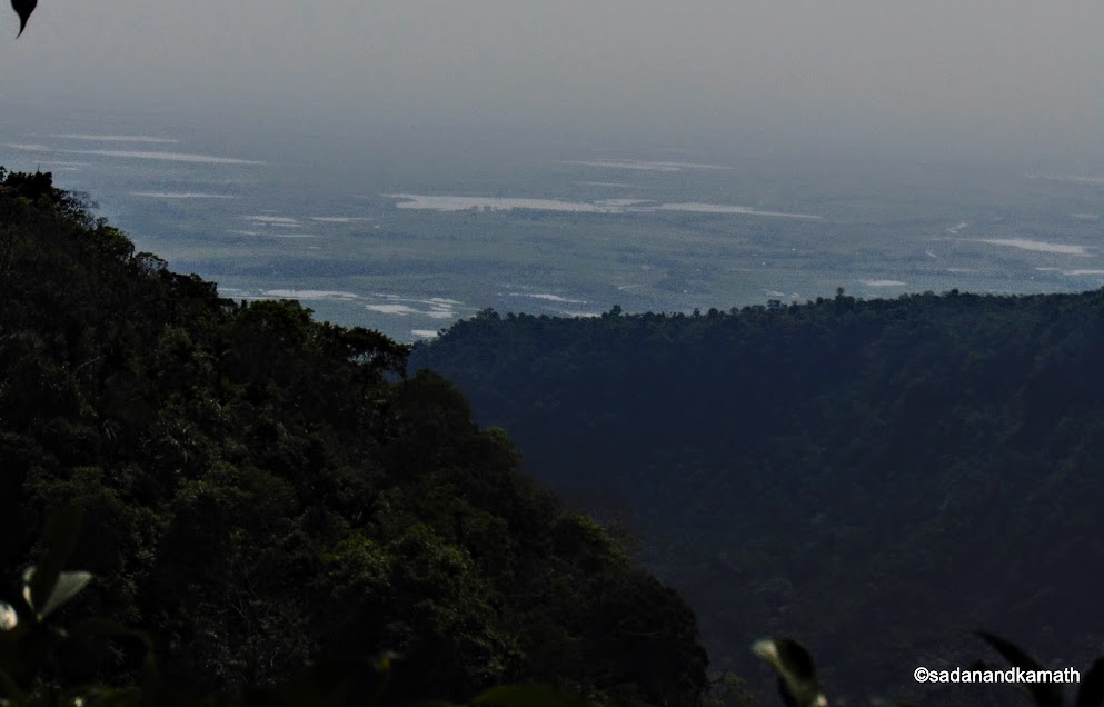
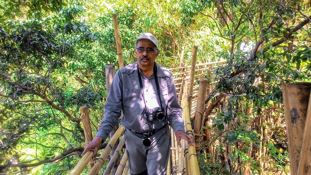
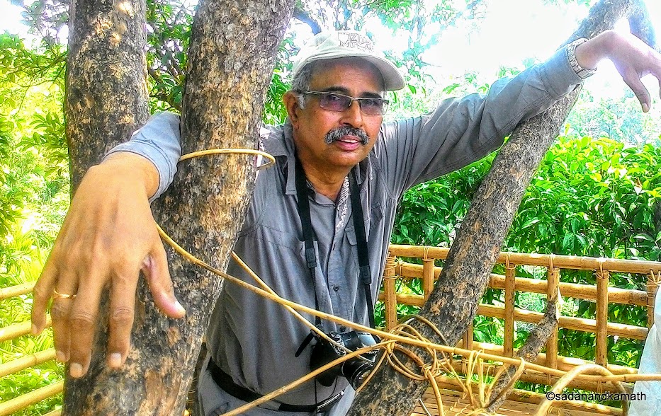
At Nohwet, there are two watch towers adjunct to each other to view Bangla Desh plains. For the first one, we climbed on a bamboo ladder-stairs to reach the tower. However, from this Tower, one gets a side view of the Bangladesh plains. For the second Tower, a bamboo bridge has been erected to reach the Tower in the middle of the tree trunk. From here, one gets a front view of the Bangla Desh plains. Since the weather was hazy, we could not get the clear views though we could make out that there were water bodies on the plains.
A village view from the road to Dawki.
A good restaurant on Dawki road with clean wash room.
On the bamboo ladder to reach the Tower-1 to view Bangla Desh plains.
View of Bangla Desh plains from the Watch Tower.
Way to Nohwet View Point.
On the bamboo bridge for Nohwet View Point (Tower-2).
On the viewing platform made up of bamboo with the support of tree trunks at Nohwet.
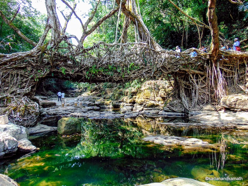
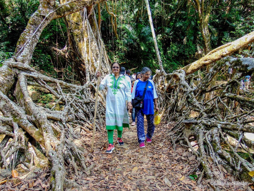
3. Riwai Living Root Bridge : While in Cherrapunjee, we had consciously avoided attempting Double Living Root Bridge and trek to Rainbow Waterfalls at Nongriat as apart from requiring two extra days, it was difficult for the aged ones to climb up and down about 3000 stone steps and then trek to reach the Rainbow Waterfalls. Having come to Megahlaya with a good number of living root bridges, it was necessary that we see at least one living root bridge. So we decided to visit Riwai Living Root Bridge near Riwai village.
From Nohwet, it was about 7 kms of drive on a single lane village road. From the road, there are two approaches to reach the root bridge. The first one which most of the tourists take, involves a longer descend on well laid-down stone stairs ending at the other side of the root bridge. The second one involves shorter descends on uneven stone stairs and ends at the one side of the root bridge. We took the second one to reach the root bridge.
There was not much of the tourist crowd. During the peak tourist season, there is a queue to cross the bridge as only 4-5 persons are permitted to walk on the root bridge at a time. We did not face any queue. A stream flows below the root bridge but being the dry month, the stream did not have much water. Apart from walking on the root bridge, tourists sit on the rocks in the midst of the stream submerging their feet in the water.
Riwai Living Root Bridge, Riwai.
Walking over the Riwai Living Root Bridge.
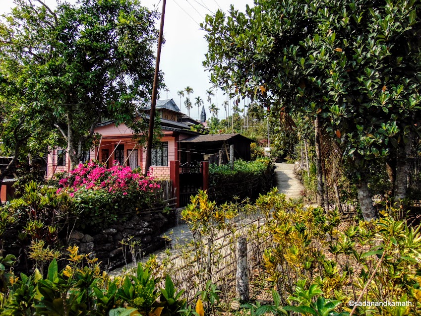
4. Mawlynnong Village : Mawlynnong village is actually west of Riwai village and is very close to it as the crow flies (about 3 kms). However, due to the difficult terrain, there is no road. So the tourists are required to take a round about route which is about 8 kms by the road. When we reached the village, there was no parking space in the Mawlynnong's only car parking. So we drove through the village until we found space for alighting from the car. Pradeep instructed us to meet him on the main road after we had completed the village walk.
Mawlynnong has been declared as Asia's cleanest village. We did find the village very clean. But so were the other villages in Meghalaya which we have visited or had passed through. During our walk on the cemented path, we found every corner of the path bamboo baskets hanging to deposit the wastes. Almost all the houses had flower plants and orchids. We also found jackfruit trees in some compound of the house apart from the usual areca nut trees.
After the completion of the village walk, Pradeep picked us on the road. Due to Good Friday, most of the small eating houses and home stays were closed. So we drove towards Dawki hoping to get something to eat as it was already 3.00 p.m. Fortunately, we had not to drive too far as just outside Mawlynnong village, Pradeep parked the car in front of an restaurant. The cook was the friend of Pradeep who went straight inside the kitchen ordering the vegetarian lunch. Though it took about 30 minutes to serve us the a la carte lunch, it was worth the wait.
A house in Mawlynnong.
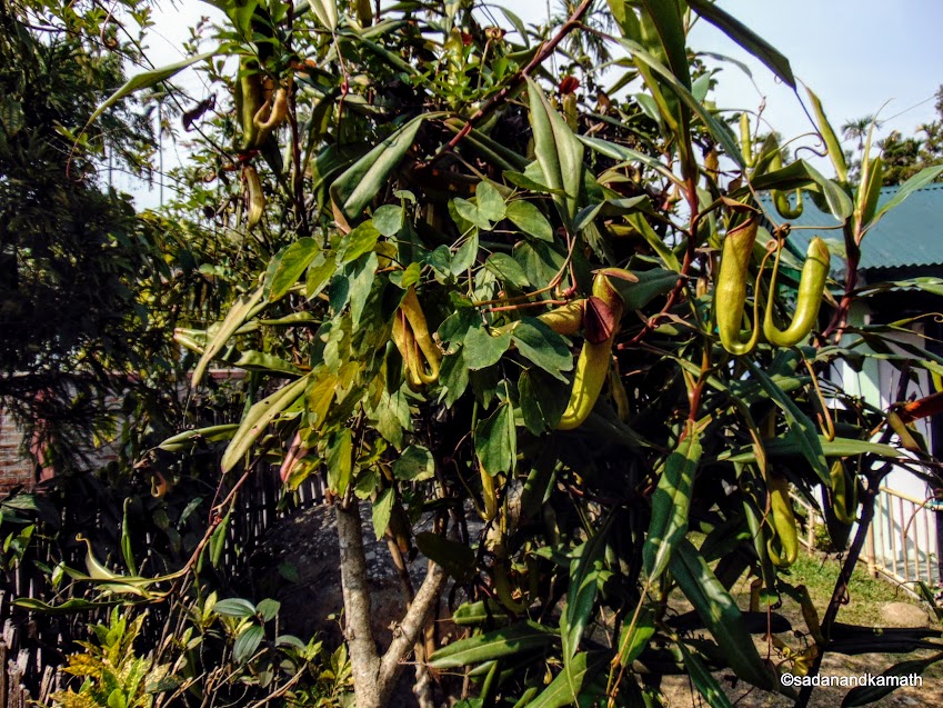
Pitcher's Plant, Mawlynnong.
This was the only good restaurant just outside Mawlynnong which was opened.
5. To Dawki-Shnongpdeng : By the time we finished our lunch, it was already 3.30 p.m. The sky was overcast and it looked like as if sun has already set in even though sunset time was around 5.30 p.m. We started the journey for Dawki. Pradeep wanted to show us the Bangla Desh plains from the road which runs very close to the Indo-Bangla Desh border. The road condition was not as good as the normal route via Pongtung. But the route was scenic with most of the drive through dense forest.
When we wee about half-way to Dawki, heavy rains lashed the region to an extent that Pradeep had to use the fastest speed of the wipers. As we came close to Dawki Waterfall, the intensity of the rain was reduced. Dawki Waterfall was reduced to a tickle. The water was flowing under the iron bridge to Bangla Desh plains. I got down from the car, took a snap of Bangla Desh plains and ran back inside the car.
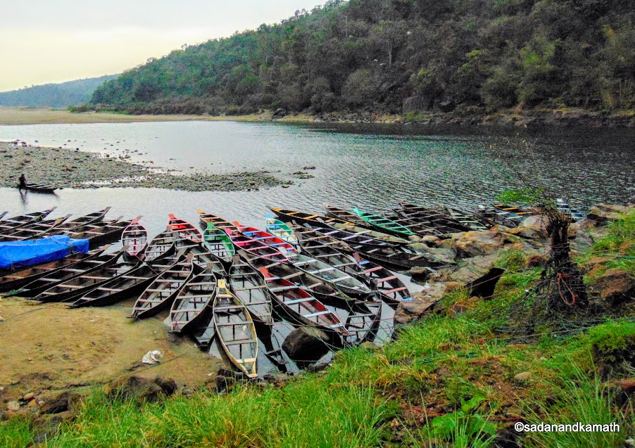
Soon we faced the usual traffic jam Dawki is known for due to heavy truck traffic to Bangla Desh via Tamabila Zero point where the vehicles enter to and exit from Bangla Desh. Pradeep had planned to take us to Tamabila Zero Point which was hardly 500m from Dawki boating point but got aborted due to traffic jam. He left us at the Dawki boating point. It was still drizzling. I and my brother-in-law walked down on the stairs to the shore of Umngot river. The visibility was poor. The boating ride was closed for the day. We took snaps and returned to the car parked at the curb.
This is the part of Bangla Desh shot from Dawki road. Dawki Waterfall feeds the stream.
.
Umngot River, Dawki.
The traffic jam was considerably reduced but it was already a closing time for Tamabila Zero Point. So we slowly drove to Shnongpdeng which was located off the Dawki-Jowai highway about 10 kms from Dawki. The owner of the Shatsngi Home Stay where we had booking was already in the parking lot in Shnongpdeng. About 200m of walk took us Shatsngi Home Stay. It has already become dark. So we had no idea about the topography of the area. But there were a good number of tourists in the area converging in 4-5 dabhas located in the area. Most of them were youngsters probably for water sports adventures.
After the rain, night had become cold with strong breeze blowing through out the night. So after a long tiring journey, we were not in a mood to go out in the cold and breezy night. The homestay owner arranged dinner for us on a dinning area specifically created in a veranda on the first floor of our log hut. There was lot of voltage fluctuation through out our stay. But an alternative lamp which was running on solar power came to our rescue during the dinner time.
No comments:
Post a Comment